The effect of ice on the degradation of impact craters on Ceres

Post contributed by Noé Le Becq, PhD candidate, Laboratoire de Planétologie et Géosciences, Nantes (France)

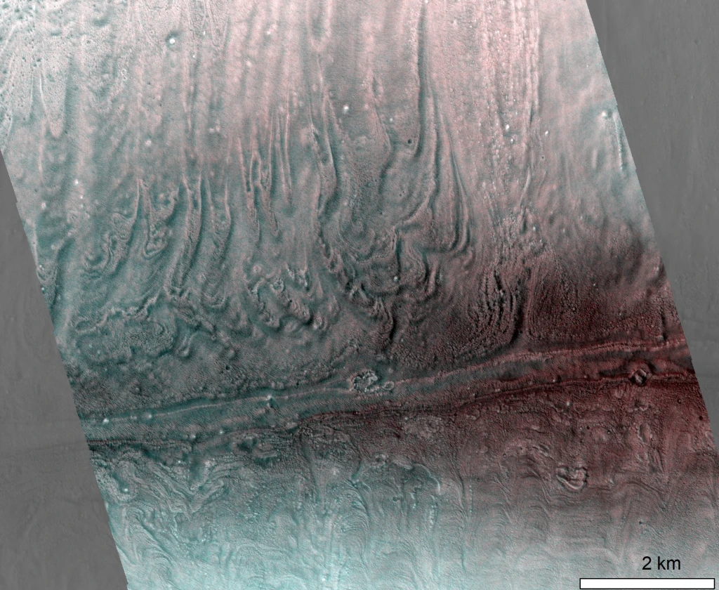
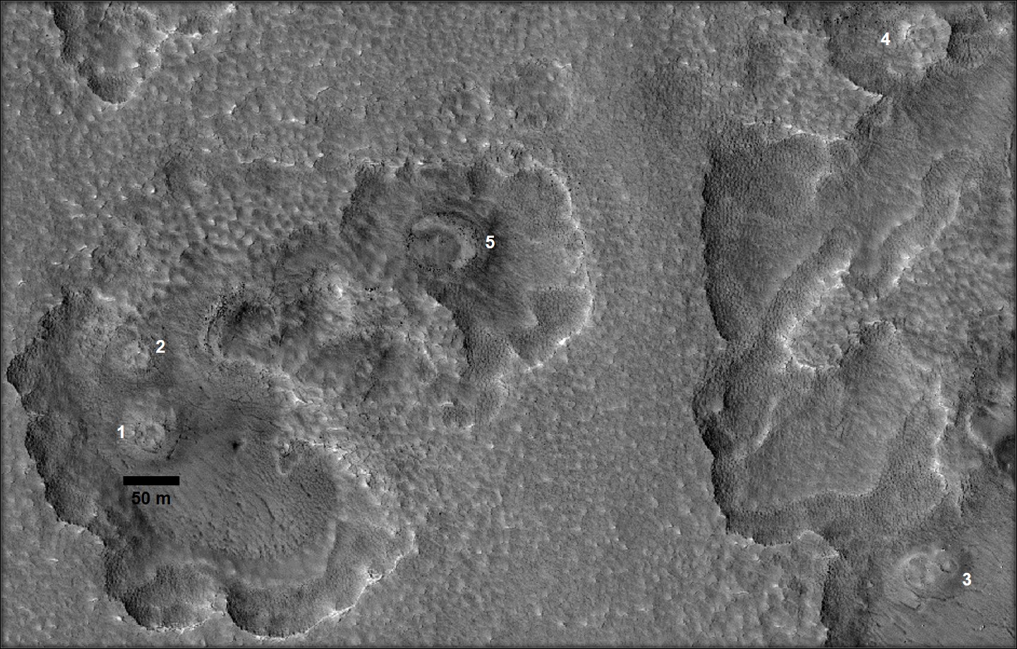
Ceres was discovered in 1801 by Giuseppe Piazzi and is located in the main asteroid belt between the orbits of Mars and Jupiter. In the mid-2000s, Hubble Space Telescope observations revealed that Ceres was ice-rich (McCord and Sotin, 2005), making it the closest icy world to Earth! Therefore, the NASA Dawn spacecraft explored it between 2015 and 2018, unveiling a dwarf planet with a crust made of a mixture of ice and rocks (Ermakov et al., 2017), and a complex surface showing signs of recent or possibly ongoing geological activity (Zambon et al., 2017; Scully et al., 2019). The absence of atmosphere makes water ice unstable when exposed to Ceres’ surface. Yet sublimation of the ice contained in the crust could be at the origin of certain morphologies observed (Sizemore et al., 2019), and could more specifically have an important role in the degradation of impact craters over time (Image 1A). After an impact, the freshly exposed ice-rich material on the crater walls sublimates, leading to its fragmentation and the formation of large talus deposits underneath (Image 1B). This is an important process in the evolution of the topography of impact craters on Ceres, very different to what is observed on rocky moons and planets of the inner Solar System.

Image 1: On the left, Ceres as seen by the NASA Dawn spacecraft during its approach in 2015. Occator crater, shown in 3D on panel A, is one of the youngest craters at the surface of Ceres and has large talus deposits along its walls. Panel B is a zoomed 3D view (with no vertical exaggeration) of the North-eastern wall of Occator crater, where the talus can be observed. Ceres approach image (PIA19558) and Occator 3D view (PIA21913) are from NASA/JPL-Caltech/UCLA/MPS/DLR/IDA.

(more…)

Surface expressions of ice flow on Earth and Mars

Post contributed by Dr Anna Grau Galofre, Laboratoire de Planetologie et Geosciences, CNRS UMR 6112, Nantes Universite, Universite d’Angers, Le Mans Universite, France.

Glaciers, ice sheets, and ice masses in general, are both agents of landscape evolution and a part of the landscape itself, when considered at human time scales, with surfaces that evolve and record changes in environmental conditions. The ages of glaciers and ice sheets on Earth, which range from thousands to millions of years, dwarf in comparison with the ages of debris-covered ice masses on Mars. Debris-covered martian ice deposits range up to hundreds of millions of years old, perhaps approaching 1 billion years old in some locations. Image 1 shows complex patterns on the surface of a debris-covered glacier on Mars. Terrestrial glacial surface deformation patterns can record changes in environmental conditions, which are also captured in the variability in chemistry and crystal structure seen in their internal stratigraphy. The morphology of a glacier surface, for example, may reflect episodes of warmer climate, and therefore enhanced ice flow; banding patterns may reflect periodic changes in the mass balance of ice accumulation and ice loss; and crevasses may reflect episodes when ice flowed relatively fast and fractured. The surface morphology of glaciers and debris-covered ice deposits can thus help us learn about the history of climate on Earth and Mars.

Image 1. Surface banding patterns on a debris-covered, cold based ice deposit (called a ‘lobate debris apron’) flowing down a canyon wall in Reull Vallis, Mars. Extract from CaSSIS image MY34_005511_224 (footprint width is 9 km). Image credit: ESA/CaSSIS.

(more…)

Ice mounds on Mars are a vault of the planet’s climate history

Post contributed by Prof. Mike Sori, Purdue University, USA

The polar caps of Mars are gigantic ice deposits, similar in size to Texas or France, and mostly made up of frozen H2O.  Like many planets and moons, Mars is littered with impact craters – the scars of violent asteroid and comet collisions.  Near to but separated from the polar caps, some craters on Mars are home to mounds of frozen H2O ice.  These “ice mounds” are much smaller than the giant polar caps, but not tiny—think the size of Rhode Island or Luxembourg instead of Texas or France—and have been discovered in dozens of craters using robotic spacecraft that collect images of the surface from Martian orbit.  An example of one ice mound is shown in Image 1.

Image 1. Ice mound located in Korolev Crater in the north polar region of Mars. The ice mound is about 37 miles (60 kilometers) wide. Image is a perspective view made from data returned by ESA’s Mars Express spacecraft.

(more…)

New Images of Europa from Juno’s JunoCam

Post contributed by Dr Candice J. Hansen, Planetary Science Institute, USA

On the 29th of September 2022 the Juno spacecraft, in orbit around Jupiter, made a close pass by Jupiter’s icy moon Europa (Image 1). The spacecraft approached from Europa’s night side, passed the terminator (day-night boundary), and departed on the day side, coming within ~350 km of the surface.  Juno’s visible color imager, JunoCam, snapped 4 images of Europa as the spacecraft sped by at a speed of 23.6 km/sec on its way to its closest approach to Jupiter.  In an elliptical polar orbit, this was the only opportunity in the mission for Juno to get close to this moon of Jupiter and the first time since the Galileo mission ended in 2003 that any spacecraft has flown so close. 

Image 1.  The first image taken by JunoCam is centered on the subjovian hemisphere, extending to ~60 deg north and south.  This was the highest resolution image acquired. Image data: NASA/JPL-Caltech/SwRI/MSSS. Image processing: Brian Swift © CC BY.

Europa is categorized as an “ocean world” with a solid ice surface over a liquid water subsurface layer.  Europa is crisscrossed by numerous cracks, bands, ridges and troughs (lineaments) that record the tidal stress the moon experiences arising from the gravitational pull of Jupiter and its other moons. JunoCam’s image reveals numerous pits along the terminator.  The almost complete lack of craters tells us that geologically this icy surface is very young, resurfaced by lineament formation due to tidal flexing.  Callanish crater, one of the few imaged by JunoCam, is the circular feature visible in the lower right of Image 1.  

(more…)

Topographically influenced evolution of large-scale changes in the smooth terrains of comet 67P/Churyumov–Gerasimenko

Post contributed by Abhinav Jindal, Department of Astronomy, Cornell University, USA.

The European Space Agency’s Rosetta mission to 67P/Churyumov–Gerasimenko (67P) provided the most detailed ever views of a comet’s surface. By tracking the comet on its journey through the inner solar system for just over two years, Rosetta observed an increasing amount of activity and surface changes as the ice-rich surface warmed up. These observations revealed that 67P had seasons. Specifically, due to its present-day obliquity and orbit, southern summer corresponds closely with perihelion. This results in orders of magnitude greater insolation at southern latitudes than in the north [Hu et al., 2017]. Accordingly, a greater number of particles are eroded and launched from southern latitudes, with a large fraction falling back onto the surface in the cold northern hemisphere [Thomas et al., 2015; Keller et al., 2017]. This creates a hemispheric dichotomy in surface morphologies – layered bedrock units that represent the exposed nucleus are dominant in the south (“rough” terrains), while topographically smooth, sediment-covered regions dominate the north (“smooth” terrains) [Birch et al., 2017]. It was within the smooth terrains that we observed the majority of changes on 67P [Groussin et al., 2015; El-Maarry et al., 2017; Hu et al., 2017; Pajola et al., 2017a; Birch et al., 2019], making them critical to understanding the overall evolution of the comet. Our work [Jindal et al., 2022] tracked some of the most dramatic large-scale changes within these sedimentary deposits (Image 1). Specifically, in the largest and most southern smooth terrain deposit – termed Imhotep – we observed dozens of pits, bounded by multi-meter high scarps, grow and migrate across the region for many months.

Image 1: Activity in Imhotep. Animation showing georeferenced images of the Imhotep region from 05/24/2015 – 01/23/2016. Activity in the region persists from 06/05/2015 – 12/06/2015 and can be seen in the form of scarps (arcuate depressions) migrating through the region. Images were downloaded and are freely available on ESA’s Planetary Science Archive (https://archives.esac.esa.int/psa) and NASA’s Planetary Science Data System (https://pds.nasa.gov), and were georeferenced using the shapeViewer software (www.comet-toolbox.com).

(more…)

Ice Deposits Revealed by Radar Within Craters on Mercury

Post contributed by Dr. Edgard G. Rivera-Valentín, Lunar and Planetary Institute, Universities Space Research Association.

Although its surface can reach 800°F (427°C), some of Mercury’s craters conceal vast ice deposits that, in a sense, “sparkle” in the light of radar (Image 1). The so-called radar bright features were first identified in 1992 using ground-based observatories, in particular the Arecibo Observatory in Puerto Rico, which provided magnificent views down to craters tens-of-kilometers in diameter all the way from Earth. The ice lies within craters whose morphology and location results in areas that do not receive direct sunlight (i.e., permanently shadowed regions). This allows for the low temperatures needed to retain ice over millions of years.

Image 1: Radar image of Mercury’s north polar terrain (> 75°N) in polar stereographic projection. The five notable craters, Chesterton (88.5°N, 126.9°W), Tolkien (88.8°N, 211.1°W), Tryggvadóttir (89.6°N, 171.6°W), Kandinsky (87.9°N, 281.2°W), and Prokofiev (85.7°N, 297.1°W) are labeled. Radar backscatter is noted in grayscale from black (below noise levels) to white (high backscatter). All bright areas are radar bright features, which are located within craters that have permanently shadowed regions. These are the locations of ice deposits on Mercury. For scaling reference, Chesterton crater has a diameter of 37.2 km. Image credit: Figure 2 in Rivera-Valentín et al. (2022) PSJ 3,62.

The discovery of the radar bright features at Mercury’s poles was one of the motivators of NASA’s MESSENGER (Mercury Surface, Space Environment, Geochemistry, and Ranging) mission, which studied Mercury between 2011 – 2015. That is because although the radar scattering properties of the features were reminiscent of observations of the Martian polar layered ice deposits, as well as of the icy moons of Jupiter, they alone did not uniquely indicate the presence of water ice. The detailed studies by MESSENGER along with the earlier radar observations together now strongly suggest deposits of water ice. This is due to their location, evidence from high resolution and long exposure imaging, and measurements of epithermal and fast neutron fluxes.

(more…)

Thermal-contraction polygons on Earth and Mars

Post contributed by Meven Philippe, Ph.D student, Laboratoire de Planétologie et Géodynamique de Nantes, CNRS/Université de Nantes, France.

On Earth, sharp drops of temperature below 0°C can cause the ground to contract and fracture, forming thermal-contraction cracks. These cracks can connect in a network, which leads to a ground that shows a polygonal pattern. Ice or sand can then seasonally aggrade as wedges into these cracks, which uplifts polygons’ margins to higher elevations than their centres, thus forming low-centered polygons. When the infilling material degrades, the elevation of the margins reduces with respect to that of the centre, thus forming high-centered polygons. The same processes are assumed to occur on Mars in the mid-latitudes. Image 1 (42.9°N, 115.43°E) is located in Utopia Planitia, a lowlands plains area in the martian Northern hemisphere where numerous potential periglacial morphologies have been described.

Image 1: Polygonal patterned ground in a crater in Utopia Planitia, Mars. The blue circle highlights examples of low-centred polygons, the red circle highlights examples of high-centred polygons. The black arrow points out the sharp border between the polygonised unit and another one, non-polygonised. Illumination is from the left. Credits: HiRISE image ESP_036366_2235 – NASA/JPL/University of Arizona.

(more…)

Smooth Plains on Europa

Post contributed by Dr. Elodie Lesage, Laboratory of Geosciences Paris-Saclay, University of Paris-Saclay.

The young (60-100 Myrs) and active surface of the Jupiter’s icy moon Europa includes various geological features. In some locations, smooth plains have been observed on Europa, defined as features with no visible texture and an albedo lower than the surrounding terrains. The smooth plains overprint the preexisting terrains, and are confined within basins bounded by topographically high features.

Image 1: Four smooth plains on Europa. The arrows show the sunlight direction. Galileo images: (a) Image 5452r, resolution: 27 m/px; (b) Image 0713r, resolution: 57 m/px; (c) Image 0739r, resolution: 57 m/px; (d) Image 9352r, resolution: 60 m/px.

The best-resolved images of Europa’s surface were acquired by the Galileo spacecraft between 1996 and 2001. Image 1 shows four smooth plains visible in Galileo images, which share the following common characteristics: i) thin features occupying topographic lows, ii) a smooth appearance with little or no visible texture, and iii) kilometer-scale width with a quasi-circular, lobate shape. The morphology of these features suggests that they result from the flow of low-viscosity fluid, such as liquid cryomagma (i.e., briny water coming from Europa’s interior).

(more…)

Martian Spiders Recreated in the Laboratory

Post contributed by Dr. Lauren Mc Keown, School of Physical Sciences, The Open University, UK.

Spiders are unusual branched landforms found among the high southern latitudes of Mars (Image 1). They have no Earth analogues and are often accompanied by fans and spots that appear in spring. They are proposed to form when sunlight penetrates the Martian south polar seasonal CO2 ice layer, causing ice at its base to change from ice to gas, and eventually crack. Escaping gas then scours the terrain beneath, carving spider-like patterns and depositing material on top of the ice via a plume (Kieffer et al., 2003). However, although this suggested process is well-accepted, it has never been directly observed on Mars. In order to investigate whether spider patterns could form by CO2 sublimation under Martian atmospheric pressure, experiments were performed (Image 2) at the Open University Mars Simulation Chamber, which simulates Martian atmospheric conditions.

Image 1: Examples of spiders on Mars (HiRISE image ESP_014282_0930). Left shows the ‘classic’ spider morphology which consists of a central depression and radial tortuous dendritic troughs emanating from its centre. Right is a context image. Image Credit: NASA/JPL/University of Arizona.

(more…)

Quantification of ice blockfall activity at a north polar scarp on Mars

Post contributed by Ernst Hauber and Lida Fanara, Institute of Planetary Research, German Aerospace Center (DLR), Berlin, Germany.

Mars is an active planet, and several processes are currently shaping its surface. Among those, gravity-driven mass wasting produces surface changes that can be quantified in image data acquired before and after discrete events. As such changes are typically small in their spatial dimensions, the prime dataset to recognize them are pairs of HiRISE images (High Resolution Imaging Science Experiment; McEwen et al., 2007), with scales of ~25-50 cm/px. The manual identification of surface changes in these huge images (a single HiRISE image can have a size of several Gigabytes) is challenging, however, and requires significant efforts. In order to circumvent this massive demand on human resources while yet taking advantage of all images, automated methods need to be developed. Here we show an example of such methods which was applied to ice block falls at a steep cliff in Mars` north polar region.

PGIM.Figure_01

Image 1: Block fall at a scarp on the north polar region of Mars near 83.796°N and 236.088°E. (a) «before» image acquired at 06 May 2014 (HiRISE image ESP_036453_2640). (b) «after» image acquired at 25 December 2019, showing a cluster of blocks that was displaced from the scarp to the right (east) (ESP_062866_2640). North is up in both images, scale bar is 100 m.

(more…)

Martian elusive Pits and the challenge of working remotely

Post by Dr. Andreas Johnsson, University of Gothenburg, Sweden

Geomorphologists working with Mars share a frustration of not being able to visit their objects of investigation. To counter this, a commonly used approach is to look for environments on Earth that resemble those studied on Mars. This approach, called Earth-analogue studies, helps to guide our line of reasoning in deciphering formation mechanisms of specific martian landforms of interest. Mars, being the most earth-like planet in the solar system hosts numerous landscapes and landforms that in plan-view show remarkable similarities to known features on Earth. Especially striking examples are martian glacial flow-like features and gullies to that resemble terrestrial glaciers and fluvially-incised ravines, respectively. As a consequence their Earth counterparts have been studied with great intensity for the last couple of decades. Although correspondences in form may guide our way of thinking of plausible formative processes by reference to Earth, the approach is not without pitfalls. For example, experimental studies in Mars climate chambers have shown that fluvially triggered slope processes may be of a completely different nature under Mars’ atmospheric conditions of low pressure combined with low temperatures, but the resulting landform looks about the same. This is a problem of equifinality (i.e. convergence of form), something that also terrestrial scientists encounter but which is a major challenge in planetary geomorphology (e.g. Hauber et al. 2011; Zimbelman 2001). One way to try to minimize equifinality is by taking whole landform assemblages into account where different types of landforms may have some genetic linkages.

(more…)

Possible Closed-System Pingos in Utopia Planitia, Mars

Post by Dr. Richard Soare, Geography Department, Dawson College, Montreal, QC H3Z 1A4, Canada.

On Earth, hydrostatic or closed-system pingos (CSPs) are perennial ice-cored mounds formed by the freeze-thaw cycling of water when or as thermokarst lakes lose their water by drainage or evaporation. The mounds vary in shape from circular or sub-circular to elongate, are sub-kilometer in their long axes and may reach decameters in height. Some mounds show summit depressions, radial fractures and tiers. As the CSPs degrade, small-scale debris flows or slumps may occur; end-stage degradation often is marked by debris-laden ramparts elevated symmetrically or asymmetrically above the surrounding terrain. The presence of closed-system pingos on Mars might thus inform us about the planets’ past and/or present hydrologic conditions (Image 1).

Fig. 1

Image 1: Candidate closed-system pingos (CSPs) at the mid latitudes of Utopia Planitia, Mars
(HiRISE image ESP 027650_2275). Note the location of the potentially ice-cored mounds in polygonised thermokarst-like depressions and the interesting mound morphologies. On Earth, CSPs form almost uniquely in the midst of drained or water-depleted thermokarst lakes (alases) that are nested in ice-rich terrain. On Mars, we propose that the depressions form by the sublimation-driven loss of near-surface ice; this would also be the principal driver of ice-core depletion and/or collapse. Mounds 1-4 exhibit circular shapes and summit depressions that are commonplace amongst CSPs in regions like the Tuktoyaktuk Coastlands of northern Canada. The crescentic shape of Mound 5 could be a marker of mound collapse and the deflation/sublimation of a near-surface ice core, the geological buttress of pingo topography on Earth.

(more…)

Evidence against vast glaciation in Mars’ grandest canyons

Post by Miss. L. Kissick, PhD candidate, Department of Earth Sciences, University of Oxford. Research conducted while at the Department of Geography, Durham University.

The Valles Marineris (Image 1) form the largest system of interconnected canyons on Mars, up to 2000 km long and in parts 10 km deep, and have long been a focal point of interest in planetary geomorphology. Recently, researchers including Mège and Bourgeois (2011), Cull et al. (2014), and Gourronc et al. (2014) outlined the case for a vast glaciation filling these canyons to several kilometres in depth. The implications of such a fill on the climate history and global water budget of Mars would be paradigm-shifting, but with high resolution imagery, features attributed as glacial may be better explained by more common geomorphological processes.

IM1

Image 1: Valles Marineris in Mars Orbital Laser Altimeter topography. This enormous canyon system is in parts 10 km deeper than the surrounding plateau, and was hypothesised to contain a glacier of a volume comparable to each Martian polar cap (Gourronc et al., 2014). Rough areas described in Image 2 are circled. Image adapted from Figure 1 of Kissick and Carbonneau (2019).

(more…)

The banded terrain on Mars – A viscous cufeve

Posted by Dr. Hannes Bernhardt, Arizona State University, School of Earth and Space Exploration.

An article on the banded terrain cannot be commenced by a traditional definition, as it appears to be a truly singular occurrence in the Solar System. In a competition for the most mysterious landscapes on Mars, the so called “banded terrain” (Image 1) would certainly be a hot contender – a fact illustrated by one of its other descriptive appellations: “Taffy pull terrain.” It is a strong reminder of the limitations that are intrinsic to remote sensing geology but also of the strengths of comparative geomorphology.

PlanGeomorph_Figure1

Image 1: CTX images of the banded terrain on the Hellas basin floor on Mars.

(more…)

Enigmatic Normal Faults on Ceres

Post by Kynan Hughson, Department of Earth, Planetary, and Space Sciences, University of California, Los Angeles, USA.

Since March of 2015 NASA’s Dawn spacecraft has been actively exploring the main asteroid belt’s largest member and only dwarf planet in the inner solar system: Ceres. Situated around two fifths of the way between the orbits of Mars and Jupiter, Ceres is gargantuan compared to its neighbors. With a mean diameter of ~946 km (approximately the width of the state of Texas) and a bulk density of ~2.16 g/cm3 it comprises around one third of the mass of the entire main belt. Dawn’s continuing examination of this unique object since March 2015 has revealed a geologically diverse world covered with geomorphological features common to both rocky inner solar system planets and icy outer solar system satellites (e.g. Bland et al., 2016; Schmidt et al., 2017; Fu et al., 2017). These observations have exacerbated Ceres’ refusal to be neatly categorized as either a rocky or icy planet.

narSulcusRotation

Image 1: A rotating aerial view of Nar Sulcus (centered at approximately 79.9 °W, 41.9 °S). Note the two nearly perpendicular sets of fractures. In particular, note the imbricated blocks within the longer fracture set. The longer fracture set is approximately 45 km long, and the deepest valleys are ~400 m deep. This scene was created using a stereophotogrammetrically (SPG) derived elevation model (vertical resolution ~15 m) and high resolution (~35 m/pixel) Dawn framing camera mosaics (Roatsch et al., 2016a; Roatsch et al., 2016b), which are available on the Small Bodies Node of NASA’s Planetary Data System.

(more…)

Geologically recent glacial melting on Mars

Post by Frances. E. G. Butcher, School of Physical Sciences, Open University, UK.

Thousands of putative debris-covered glaciers in Mars’ middle latitudes host water ice in volumes comparable to that of all glaciers and ice caps on Earth, excluding the Greenland and Antarctic ice sheets (Levy et al., 2014). These glaciers formed within the last 100 million to 1 billion years of Mars’ geological history (Berman et al., 2015), a period that is thought to have been similarly cold and hyper-arid to present-day Mars. This is broadly corroborated by a sparsity of evidence for melting of these geologically ‘young’ mid-latitude glaciers, which suggests that they have always been entirely frozen to their beds in ‘cold-based’ thermal regimes, and haven’t generated meltwater (e.g. Marchant and Head, 2007). Nevertheless, this months’ planetary geomorphology image provides evidence for melting of one such glacier.

Image1

Image 1: An esker emerging from the tongue of a debris-covered glacier in Tempe Terra, Mars. See Image 2 for an annotated 3D view of this scene. The dashed white line delineates the terminus of the debris-covered glacier, which occupies the southern and eastern portions of the image. The white arrow marked A indicates the first emergence of the crest of the esker ridge from the glacier surface. The white arrow marked A’ indicates the northernmost end of the esker ridge in the deglaciated zone beyond the ice terminus. Context Camera image P05_002907_2258_XN_45N083W (Malin et al., 2007). Modified from Butcher et al., 2017 under a Creative Commons license CC BY 4.0.

(more…)

Enigmatic Clastic Polygons on Mars

Post by Laura Brooker, Open University, Milton Keynes, UK.

Polygonal ground of centimetre- to decametre-scale is one of the most common features found in cold-climate regions on Earth and on Mars. Polygonal shapes on Earth can form through a number of different processes including the thermal contraction of ice-cemented soils, forming fracture patterns known as thermal contraction polygons, through the freezing and thawing of ground ice moving clasts, in the case of sorted patterned ground, or through the dehydration of volatile-rich material, termed desiccation polygons. Around a large crater found in the northern latitudes of Mars, named Lyot, we observe stunning and unusually large clastic polygons (Image 1), but how do they form? To understand landforms on Mars we turn to analogues on Earth and compare morphological data to look for similarities and differences.

Image 1

Image 1: HiRISE (ESP_016985_2315) image of clastic polygonal ground observed to the north east of Lyot crater, Mars. These enigmatic polygons are demarcated by clastic material in their borders and are averagely 130 metres in diameter. Image credit: NASA/JPL/University of Arizona.

(more…)

A Wunda-full world? Carbon dioxide ice deposits on Umbriel and other moons of Uranus

Post contributed by Dr. Mike Sori, Lunar and Planetary Laboratory, University of Arizona

Uranus and its moons have only ever been visited by one spacecraft, Voyager 2, which flew by the system in 1986.  One of its large moons, Umbriel, was found to have a mysterious bright ring 80-km-wide inside a 131-km-diameter crater named Wunda.  Image 1 shows Umbriel and this annulus-shaped feature.


Image 1 blog post

Image 1: Voyager 2 image 1334U2-001 showing the Uranian moon Umbriel; note the bright ring inside the crater Wunda at top of the image (which is at Umbriel’s equator).

(more…)

Pit chains on Enceladus

Post contributed by Dr. Emily S. Martin, Research Fellow, Center for Earth and Planetary Studies, National Air & Space Museum, Smithsonian Institution.

Pit chains are linear assemblages of circular to elliptical pits and have been observed across the solar system. Pit chains have been found on Venus, Earth, Mars, Phobos, Eros, Gaspra, Ida, and Vesta. Across the solar system, pit chains may form through a variety of mechanisms including the collapse of lava tubes, karst, venting, extensional fracturing, or dilational faulting. Saturn’s tiny icy moon Enceladus is the first body of the outer solar system on which pit chains have been identified. Enceladus is only 500 km in diameter and is best known for its warm south pole and its watery plume emanating from prominent ridges known as tiger stripes. The source of the plume is likely a global liquid water ocean beneath an icy shell.

Image1

Image 1: The morphology of pit chains across the solar system. a. Eros from NEAR. Image no. 135344864. b. Phobos. Image PIA10367. c. Albalonga Catena, Vesta. d. Venus. Right-look Magellan data near 13°S, 112°E. e. Kilauea Volcano, Hawaii centered at 19.3909°N 155.3076°W. Image taken 12/06/2014, acquired from Google Earth on 04/20/2016. f. Ida, modified from image PIA00332. g. Gaspra, modified from Galileo image PIA00332. h. Pit chains in north-eastern Iceland centered near 65.9902°N and 16.5301°W. Image taken on 7/27/2012, acquired from Google Earth 04/20/2016. i. Pit chains on Mars from the Mars Global Surveyor Mars Orbiter Camera, centered near 6.5398°S and 119.9703°W on the flank of Arsia Mons. Image PIA02874.

(more…)

Frozen Seas on Mars and Earth


Posted by
Dr. Matt Balme, Open University, UK. 

(Re-posted from IAG Image of the Month, October, 2007)

Elysium Planitia

Images of the ‘frozen sea’ on Mars (a,b) from the High Resolution Stereo Camera of the ESA Mars Express Mission, and pack-ice (c) in the terrestrial Antarctic.

(more…)

  • Enter your email address to follow this blog and receive notifications of new posts by email.

  • Io

  • Blog Stats

    • 192,913 hits