Field Guide to an Ancient Martian Lake Bed

Post contributed by Dr. Zach Dickeson, Department of Earth Sciences, Natural History Museum, London, UK.

At geological timescales, individual lakes are only transient features on the Earth’s surface. Conditions within lake basins change over time, eventually filling with sediment, drying up, or draining completely by steady erosion (or catastrophic breach) of the basin margin. Sites where lakes existed in the past are known as palaeolakes, and in addition to Earth, hundreds of examples have been identified on Mars (Goudge et al., 2015). Rather than a single characteristic landform, palaeolakes on Mars are typically identified by a set of topographic and morphological features such as shown in Image 1. Careful investigation of associated river valleys, deltas, layered deposits, and shoreline terraces can reveal details of a lake’s origin, development, and eventual demise (Dickeson et al., 2022).

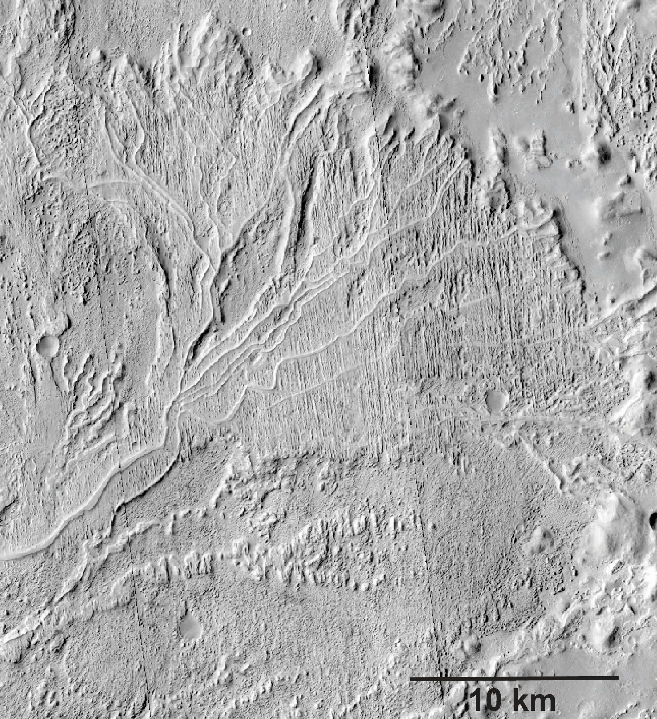
Image 1: Deposits and landforms within a palaeolake in Arabia Terra, Mars. Two past lake levels are represented by contours defined by outlet valley elevations. The inlet valley is visible at the bottom of the image where it enters the palaeolake basin. A broad, flat-surfaced sediment fan with a steep front sits at a higher elevation, and is incised through by the inlet valley, which continues into the basin to terminate at the apex of a lower and more heavily weathered sediment fan. The two fans are interpreted as deltas, and match the two different fill levels within the palaeolake. Context Camera image D12_031993_2114_XN_31N014W; http://viewer.mars.asu.edu/viewer/ctx/D12_031993_2114_XN_31N014W; NASA/JPL/MSSS/University of Arizona.

(more…)

The Jezero Crater Western Delta, Mars

Post contributed by Axel Noblet, Laboratoire de Planétologie et Géodynamique de Nantes, CNRS/Université de Nantes, France

Jezero Crater on Mars will soon be explored by NASA’s Perseverance rover. This crater has been interpreted as a paleolake. It contains two fan-shaped deposits in the northern and western portions of the crater. These deposits have been interpreted as ancient deltas. The delta located in the western portion of Jezero (Image 1) displays some of Mars’ best-preserved fluvio-deltaic features, and exhibits a variety of structures such as inverted channels and point-bar strata (Image 2). This delta contains a precious record of various depositional environments, and in situ exploration can give us insight of Mars’ fluvio-lacustrine history. The association of well-preserved lacustrine features with orbital detections of carbonates along the inner margin of Jezero points toward high biosignature preservation potential for these deposits. Hence Jezero’s western delta contains a record of the evolution of Mars’ ancient climate and possible habitability. The presence of a long-lived lake system on Mars is astrobiologically significant, and the deposits within the Perseverance landing site could have preserved biosignatures that could be investigated and cached for a future sample return mission. 

Image 1: 3D view of Jezero western delta, looking north from the center of the crater. The data visualized here is a CTX camera orthorectified mosaic draped over a CTX digital terrain model (horizontal resolution: 20m/px). The triangular ‘birdfoot’ shape of the delta is clearly visible, and inverted channels can be seen radiating from the apex of the delta. The inlet valley goes diagonally from the upper left of the image through the delta deposits. The crater floor appears as the smooth terrains on the lower part of the image.

(more…)

Geological Evidence of a Planet‐Wide Groundwater System on Mars

Post by Dr. F. Salese, Marie Curie Postdoctoral Fellow, Faculty of Geoscience, Utrecht University.

Groundwater had a greater role in shaping the Martian surface and may have sheltered primitive life forms as the planet started drying up. Observations in the northern hemisphere show evidence of a planet‐wide groundwater system. The elevations of these water‐related morphologies in all studied basins lie within the same narrow range of depths below Mars datum (Image 1) and notably coincide with the elevation of some ocean shorelines proposed by previous authors. Most previous studies on Mars relevant groundwater have proposed models, but few have looked at the geological evidence of groundwater upwelling in deep closed basins in the northern hemisphere equatorial region. Geological evidence of groundwater upwelling in these deep basins is a key point that will help to validate present-day models and to better constraint them in the future.

Figure 1

Image 1: Morphologies inside several basins. a) Crater #15 shows the presence at the same time of delta, sapping valleys, debris and hummocky terrain. The basin floor is flat. b) Crater #12 shows stepped delta, terraces, shorelines and flow structures at about the same topographic elevations. c) Sapping valley and related stepped delta in crater #18. d) Sapping valley and related stepped delta along with fan and exhumed channels in crater #12. e) Crater #16 shows well-preserved outcrops of debris flow. f) Sapping valley with related delta at -4100m inside crater #22.

(more…)

Universality of delta bifurcations

Post by Dr. Robert C. Mahon, Department of Earth and Environmental Science, University of New Orleans

Which morphologic features of sedimentary systems persist into the stratigraphic record? Ancient river deltas preserved as stratigraphic deposits on both Earth and Mars exhibit remarkable morphologic similarities to modern deltas on Earth (Images 1-3). While channel dynamics may be expected to alter the geomorphic expressions of past channel networks, in many cases channel bodies appear to be preserved in their original configurations. Fully understanding the ways in which geomorphic features become preserved as stratigraphy can provide tools for us to both infer past processes from the ancient deposits with greater confidence, as well as to predict the geometries of ancient deposits in the subsurface (i.e. for resource exploration).

Aeolis

Image 1: CTX image mosaic of a delta in the Aeolis region of Mars, showing distributary channel networks. CTX imagery courtesy of NASA-MRO/JPL/UA.

(more…)

Morphological Evidence that Titan’s Southern Hemisphere Basins are Paleoseas

Post by Samuel Birch, Cornell University, Ithaca, USA.

Titan is the only body in the solar system, besides the Earth, known to currently have standing bodies of liquids on its surface [Stofan et al., 2007]. Presently, liquids are restricted to the polar regions (>50o) with liquid bodies in the North encompassing 35 times more area as compared to the South [Hayes et al., 2011; Birch et al., 2017a]. Apsidal precession of Titan’s obliquity over ~100,000 year cycles, analogous to the Earth’s Croll-Milankovitch cycles, likely forces liquids from pole-to-pole, and has been invoked as a physically plausible mechanism to account for the dichotomy [Aharonson et al., 2009]. General circulation models support such a mechanism, as Titan’s current orbital configuration produces more intense, high-latitude, baroclinic eddies over the southern hemisphere, preferentially depositing more liquid at the northern pole [Lora & Mitchell, 2015]. These models, therefore, imply that the presence of northern liquids is transient over geologic timescales. Large basins able to accommodate ~70,000 km3 of liquid methane and ethane [Hayes, 2016] are required when orbital and climatic conditions become favorable for the accumulation of southern seas. Our study [Birch et al. 2017b] identifies four large basins, all of which show morphological evidence for having been formerly filled by liquids.

SB_Image1

Image 1: Polar stereographic projection of SAR image data of the South polar region extending out to 60o latitude. SAR image data includes all flybys up to and including T98. A mosaic of ISS data underlays the SAR mosaic. The perimeters of the four basins that we identified are highlighted in yellow.

(more…)

Stepped Fans and Phyllosilicates on Mars

Post by Peter Grindrod, Natural History Museum, London, UK.

A number of different studies have catalogued features on Mars that could be given the general heading of sedimentary fans [e.g. Irwin et al., 2005; Kraal et al. 2008]. These features occur whenever the velocity of a river or stream decreases, and the water no longer has enough energy to carry its sediment, and thus begins to deposit its load. This drop in energy often occurs when the water flows into flatter and wider regions. The distribution of these fans on Mars is important because it shows the location of past water flows, and the amount of material that has been transported (which can be used as a proxy for flow duration).

However, one of the fundamental problems when looking at these features with orbital data alone, is that it is difficult to determine whether the river flowed into a standing body of water (for example a lake) or just an empty canyon or crater. Of course, the implications of this problem are important if we want to understand the volume and distribution of past water on Mars, which in themselves feed into understanding the past climate and even habitability of Mars.

Figure 1

Image 1: Location of the two fans in Coprates Catena, SE Valles Marineris. MOLA elevation overlain on THEMIS daytime image.

(more…)

Sedimentology and Hydrology of an Amazonian paleo-fluivo-lacustrine systems on Mars (Moa Valles)

Post contributed by Francesco Salese from IRSPS/Dipartimento INGEO, Università D’Annunzio, Pescara, Italy.

Mars, is one of the planetary bodies where water flowed and where it may transiently flow today under certain conditions. Many martian paleodrainage systems and well-preserved fluvial and lacustrine deposits have been recognized and studied in the last two decades (see further reading). Widespread dendritic valley networks and the presence of extensive fluvial features on ancient martian terrains suggest that a relatively “warm and wet” climate was prevalent early in the planet’s history (about 3.7 Ga). This is in stark contrast with the hyper-arid, extremely cold climate that is thought to have persisted from 3 Ga until the present (Amazonian Era). The subject of this post is Moa Valles [Salese et al., 2016], which is a 2 billion year old paleodrainage system (Figure 1) that is nearly 300 km long and is carved into ancient highland terrains of Tempe Terra in the northern hemisphere of Mars. Understanding the origin and evolution of this type of complex and interconnected paleo-fluvio-lacustrine system is critical for understanding the early martian climate.

Figure2

Figure 1: The upper panel shows the THEMIS-VIS daytime mosaic of Moa Vallis system.The lower panel is a line drawing showing the channel system in blue lines, red dotted lines represent wrinkle ridges, the drainage basin is delimited in grey, and fan-shaped and deltaic deposits in orange. The total mapped length of the channel as shown here is ~325 km, and the flow direction is towards the east.

(more…)

Experimental Delta Formation in Crater Lakes

Post by G. de Villiers, Faculty of Geoscience, Utrecht University.

Fan-shaped deposits have been identified on the surface of Mars (Image 1). These sediment bodies often occur within impact craters and, specifically in the cases of fan deltas, suggests that these craters were once lakes early in Martian history. Fan delta morphologies are indicative of upstream (e.g. flow discharge and sediment properties) and downstream (e.g. basin characteristics) parameters, from which the hydrological conditions at the time of formation can be inferred (e.g. Kleinhans et al. 2010).

IAGFigure1

Image 1: Examples of fan delta deposits on Mars, formed in enclosed impact crater or rift basins. A) Single-scarped, branched prograding delta (PSP_006954); B) Single-scarped, smooth prograding delta (I10805012); and C) Multiple-scarped, stepped retrograding delta (V17040003). White line is approximately 5 km.

(more…)

  • Enter your email address to follow this blog and receive notifications of new posts by email.

  • Io

  • Blog Stats

    • 192,907 hits