Post contributed by Dr. David A. Vaz, Centre for Earth and Space Research, University of Coimbra.
Mars lost a part of its atmosphere to space, a process that transformed the planet from a wet planet into a cold and arid place. The extension and timing of this climatic change are still uncertain. To assess the magnitude of this environmental change we must investigate the Martian geological record. Sedimentary deposits of aeolian origin are common on Mars (Image 1) and may provide valuable information about Martian environmental changes. However, we first need to understand how the diverse bedforms that exist on Mars’s surface form, and evaluate the boundary conditions that control their morphologies. Particularly, relationships between the size of aeolian bedforms and variable atmospheric density may be used to interpret the sedimentary record and infer paleo-environmental conditions through time.
Image 1: Barchan dune covered by dark-toned ripples with spacings between crests of ~3 m. These bedforms are migrating over brighter-toned transverse aeolian ridges (TARs). HiRISE image ESP_027864_2295_COLOR (credit: NASA/JPL/University of Arizona).
Post contributed by Dr. Matthew Chojnacki, Planetary Science Institute, Lakewood, CO, USA.
Megaripples, which are intermediate-scale aeolian bedforms as compared with ripples and dunes, have been studied extensively on Mars and thought to be largely inactive landforms from past climates. On Earth, “megaripples” can be 30 cm to tens of meters in spacing with an abundant coarse sand population resulting in reduced migration except for very strong storm events. We mapped the extensive sand seas across the north pole of Mars for the presence of Martian megaripples (Image 1).
Image 1. HiRISE perspective view of north polar dune fields with active megaripples (arrows). Megaripple activity is most evident on the upwind edges of dune fields and in some cases within inter-erg areas. Clusters of contiguous megaripple fields often flanked by ripples and dunes were most common, while occasionally occurrences of mobile megaripple trains atop of bedrock were observed. All images and associated digital terrain models can be accessed at: https://hirise.lpl.arizona.edu/ Credit: NASA/JPL/University of Arizona.
Post contributed by Dr. Alexander Barrett, School of Physical Sciences, The Open University, UK.
Transverse Aeolian Ridges (TARs) are a distinctive aeolian landform, commonly found on the surface of Mars (Balme et al., 2008; Bourke et al., 2006). They consist of metre to decimetre scale granular ripples, which form transverse (i.e. perpendicular) to the direction of the prevailing wind. Similar to terrestrial megaripples, TARs are believed to form through surface creep of coarse particles. Understanding the distribution of TARs is important for understanding the aeolian environment in which they formed (Favaro et al., 2021), and for planning rover missions (Balme et al., 2018). TARs present a potential hazard when they occur in rover landing sites. Consequently, a team at the Open University has trained a machine learning model called NOAH-H (developed by SciSys Ltd. for the European Space Agency; Woods et al. 2020) to identify these features, and distinguish them from other common surface textures (Barrett et al. 2021).
Image 1 shows bedforms in Oxia Planum. The size and prevalence of bedforms in this area is important, since it is the landing site for the ExoMars Rosalind Franklin Rover (Vago et al., 2017), which will arrive in 2023 to search for signs of past and present life in this once water-rich area (Quantin-Nataf et al., 2021). Large bedforms, or continuous regions of loose aeolian sand, could form navigational hazards, limiting the directions in which the rover can progress, or the science targets that it can access. We need to have a good understanding of the distribution of TARs in the immediate area where the rover will land, however this is not precisely known in advance and could be anywhere within a large landing ellipse. Mapping all of the TARs in the potential landing area by hand is impossible in the time available, even for a large team.
Image 1: Large TARs at the planned ExoMars Rosalind Franklin rover landing site at Oxia Planum, Mars (High Resolution Imaging Science Experiment (HiRISE) Image ESP_048292-1985. a) translucent layer showing Machine Learning produced terrain classification, overlying the red-band HiRISE image from which the classification was made. The area is dominated by rugged and fractured bedrock, while topographic lows contain non-bedrock material. This has been shaped into TARs of various sizes and degrees of continuity. The divide between bedrock and non-bedrock textures is well defined, as are the perimeters of patches of TARS. The transitions between textured, fractured and rugged bedrock are less well identified, as these features form a continuum, and so some areas have characteristics of multiple classes. HiRISE Image Credit NASA/JPL/University of Arizona.
Post contributed by Divya M. Persaud, University College London, UK/NASA Jet Propulsion Laboratory, USA.
This canyon, Sakarya Vallis, cross-cuts the central mound of Gale Crater, Mars, and was probably formed by fluvial erosion. Gale Crater, the exploration site of the Curiosity rover, has undergone a complex geologic history of aqueous and aeolian processes. The central mound is a topographic high in the center of the crater, on which the ~5.2 km peak Aeolis Mons is situated. This feature sports several canyons (which cut through it), yardangs, and spectacular exposed layers, and its origins are uncertain (likely aeolian and/or fluvio-lacustrine). Image 1 shows the largest canyon on the mound, at 26 km long, up to 3.5 km wide, and up to 400 m deep. The hundreds of meters of exposed layers in this canyon provide a glimpse into the depositional history of the central mound of Gale crater.
Image 1: A 3D perspective view of the interior of the channel, visualized from HiRISE Digital Terrain Model DTEEC_006855_1750_007501_1750_A01 and HiRISE image PSP_007501_1750. This view shows the exposed layers and a possible fracture on the eastern wall (left), while the topography of the bright, inverted feature can be seen on the floor of the canyon. The floor of the canyon is overlaid by ripples. The scalebar is oriented north.
The center of Sakarya Vallis is approximately 27 km from and 700 m higher in elevation than the base of Gediz Vallis, the approximate location of the Curiosity rover (as of February 2021, sol 3038). The layers exposed in Sakarya Vallis therefore represent later depositional events than those encountered by Curiosity to date. As the rover ascends the mound towards Aeolis Mons, this geology could help contextualize rover observations and constrain lateral differences in palaeoenvironment.
The canyon cross-cuts layered hydrated sulfates in the lower mound, while spectra of the upper mound point to a dust composition. The surface of the upper unit (Image 2) is an etched, yardang unit. Yardangs are streamlined features eroded by the wind.
Image 2: A) An overview of the canyon on the central mound from CTX imagery. The slope of the canyon is to the northwest. The surface of the mound is etched by yardangs and in-filled craters. B) A close-up view of the northern, lower half of the canyon, from HiRISE image PSP_007501_1750. The extent of the inverted feature can be seen on the floor.
Within the canyon are possible point bars formed by past rivers (Image 2), mass-wasting features (Image 3), ripples (Image 1), and boulder-scale lag deposits along the floor and clifftops. A bright, topographic feature resembling an inverted channel or meander belt (Image 1) extends along much of the canyon floor and may represent later flow of liquid water, and subsequent topographic inversion by erosion of materials surrounding the channel.
Image 3: Layers exposed in the northern part of the canyon in a possible mass-wasting feature (HiRISE image PSP_007501_1750). These layers are sub-horizontal and dip gently to the northwest. The ripples on the floor have wavelengths of 10-20 m.
Post contributed by Dr. Ryan C. Ewing, Department of Geology and Geophysics, Texas A&M University
Ripples cover the surfaces of sand dunes on Earth and Mars. On Earth, ripples formed in typical aeolian sand (e.g., 0.1 and 0.3 mm) range in wavelength between 10 and 15 cm and display a highly straight, two-dimensional crestline geometry. Ripples are thought to develop through a process dominated by the ballistic impacts of saltating sand grains in which wavelength selection occurs through the interplay of grain size, wind speed, the saltation trajectories of the sand grains, and ripple topography.
Figure 1: Wind-blown impact ripples from Mesquite Flat Sand Dunes, Death Valley, USA. Pen is ~15 cm. Inferred transport direction is to the right on the image. Image credit: Ryan C. Ewing
Post by Mr Martin Voelker and Dr. Daniela Tirsch, Institute of Planetary Research, German Aerospace Center, Berlin.
In July 2012 the Context Camera (CTX) on board Mars Reconnaissance Orbiter (MRO) observed an upcoming and well-defined dust storm in a giant impact basin in the southern hemisphere on Mars known as Hellas Planitia. Although this deep lowland is notable for its dust storms, this image shows a unique view of a nascent storm system; from its first gusts to its shredded front.
Image 1: Dust storm event in eastern Hellas Planitia. The white area at the left of the image is the east-west trending wrinkle ridge. Note the helical currents in its southern part and the flow front in the very north (CTX image D02_027836_ 1333_XN_46S272W). Image credit: NASA, JPL, Malin Space Science
Posted by Jan Raack, Institut für Planetologie, WWU Münster, Germany
Image 1: Smooth appearing atmospherically derived dust-ice mantle on a south-west facing mountain slope. The flow direction of the gullies is from north to south. The gullies only erode the dust-ice mantle; the underlying bedrock was not substantially eroded. A modified dust-ice mantle indicates as viscous flow features(black arrows) are visible at the termini of the aprons. Subscene of CTX-image P05_003170_1331_XI_46S050W
Gullies are erosional-depositional landforms consisting of a source area (alcove), channel and apron. They occur primarily on mountain slopes and on crater walls on Mars. Morphologic attributes such as braided channels, point bars, and cut banks in many gullies suggest that fluvial processes were involved in their formation. The most plausible agent to form gullies is liquid H2O (groundwater seepage, melting of near surface ice and snow, or melting of a dust-ice layer on the surface). Alternative gully formation processes on Mars include the sublimation of CO2 or dry granular flows. Gullies have a wide range of ages and age determinations by crater size-frequency distribution measurements (a method used in planetary science to date surfaces via the size and frequency of impact craters) show that gullies on Mars were active in the past few million years. (more…)
Post by Matt Chojnacki, Devon Burr and Jeff Moersch, Earth and Planetary Sciences Department and Planetary Geosciences Institute, University of Tennessee Knoxville, USA
Aeolian transport of sand-sized particles on planetary surfaces is both enhanced and inhibited by the presence of topography. Mountainous topography at all length scales significantly affects dune location, size, shape, and orientation [Pye and Tsoar, 1990]. The surface of Mars has both abundant sand dune populations and substantial topographic relief. Perhaps the best example of the relationship between topography and relief is the ancient rift valleys of Valles Marineris, with over ~21,000 km2 of dune fields found within the ~10 km deep rift system [Chojnacki and Moersch, 2009]. This system of interconnected-chasms, provides natural sinks where wind blown sediment can accumulate. Additionally, the substantial relief and the resulting atmospheric pressure gradient significantly influence the regional meteorology [Rafkin and Michaels, 2003].
Dune fields in Valles Marineris can be broadly divided into two classes: floor- and wall-related dune fields. The “wall dunes” class dune fields are interpreted as climbing and falling dunes [Chojnacki et al., 2010]. On Earth, climbing dunes are formed when migrating dunes encounter and ascend a substantial slope or cliff (>10°), where there is no major wind flow blockage [Pye and Tsoar, 1990]. Falling dunes, found on the downwind side of large topographic highs, are formed by unidirectional down slope winds and gravity [Greeley and Iversen, 1985].
Climbing Dunes of Valles Marineris:
Image 1: Oblique southward perspective views of Melas Chasma climbing dunes using a CTX Camera image (P16_007245_1648) over HRSC elevation (H0334). The white arrows indicate slip faces and are consistent with upslope transport. Vertical exaggeration is 2x.
Department of Earth and Planetary Sciences, University of Tennessee, Knoxville, TN
The 2011 arrival of the Mars Exploration Rover Opportunity at the western rim of Endeavour crater (Cape York) provided an excellent opportunity to look for aeolian dune activity over a multi-season time span (Figs. 1 & 2) and compare them to the decade-long orbital observations documented at that site (Chojnacki et al., 2011). Here are some of the first images from a dedicated Pancam campaign to monitor these dunes and to document any aeolian surface changes (also see Chojnacki et al., 2012).
Image 1. HiRISE (McEwen et al. 2007) image PSP_005779_1775 of Endeavour crater’s western dune field. Inset shows a CTX (Malin et al. 2007) mosaic with the dune field’s location relative to Cape York and the Opportunity rover.
Postdoctoral Fellow, School of Earth and Space Exploration, Arizona State University, USA
Several large, overlapping basins dominate the northern hemisphere of Mars, and are collectively termed the northern lowlands. This ancient basin has been infilled by sediments and hosts some of the darkest terrains on the planet. A new spectral investigation of these dark terrains has revealed that they are almost entirely composed of iron-bearing glass. This is the first detection of glass on Mars, as most other martian surfaces exhibit a typical basaltic composition with abundant olivine and pyroxene. In total, glass-rich materials cover nearly ten million square kilometers in the northern lowlands (Horgan and Bell, 2012).
Image 1 Caption: The prime meridian of Mars from Hubble. The large dark region in the northern hemisphere (Acidalia Planitia) is approximately 5 million square kilometers in area. The north polar cap and encircling north polar sand sea can also be seen at the top of the image (NASA/Lee/Bell/Wolff)
Post by Dr. Lori Fenton, Carl Sagan Center SETI Institute, 189 Bernardo Ave., Suite 100, CA 94043
Fields of dunes and sand sheets are common on Mars. The largest type of dune is made of dark sand, which is thought to be similar in composition to the mafic sands often found near volcanoes on Earth (such as the “black beaches” of Hawaii). As on Earth, aeolian dune fields accumulate where sand is deposited by the wind, typically in low-lying areas such as basins, canyons, and craters.
Image 1: Sub set of Context camera image B11_013963_1120 showing unusual-shaped intra-crater dunefield. The inset on the upper right shows the context of the image on colorized MOLA topography, showing the unnamed crater that contains the dune field. Note the small bright dust devil crossing the dark sand (red arrow). Many dust devil tracks cross the dune fields in the southern high latitudes, removing dust that has settled out of the atmosphere.
Ventifacts are rocks abraded and shaped by windblown particles, characterized by their distinctive morphology and texture (Laity, 1994). Many show one or more facets, separated by sharp keels that form through progressive planation by impacting sand grains (Laity and Bridges, 2008).
Image 1: Martian ventifacts showing windward-facing beveled surfaces (facets) and striations that parallel the wind direction. Wind tails often form behind the ventifacts. Spirit Sol 584, 11:41:36 Local Solar – PanCam, Left 2
Yardangs are elongate wind erosion features that occur at all scales from micro-yardangs (centimetres in height, up to a metre in length) to meso-yardangs (metres in height, ten or so metres in length) and ultimately mega-yardangs (tens of metres in height, hundreds of metres of kilometres in length).
Image 1: Pseudo-true colour, oblique projected HRSC image of mega-yardangs south of Olympus Mons being eroded into the Medusae Fossae Formation. HRSC Image Archive
Ventifacts are rocks abraded by windblown particles, generally or exclusively sand (Laity and Bridges, 2009). On Earth, they are found mostly in arid regions with little vegetation, a fairly abundant supply of sand (or an ancient supply for relict ventifacts), and winds capable of exceeding the threshold speed necessary for sand movement. Their form depends on original rock texture, shape, and composition, with common forms including facets sloping into the wind and wind-aligned elongated pits, flutes, and grooves. The direction of facet dip slopes and the long axes of textures serve as proxies for the predominant highest speed winds that carried the sand and thereby serve as paleowind indicators. It is common for ventifact textures to result from mineralogical or petrological hardness variations in the rock or from primary textures such as vesicles.
Image 1:a) Elongated pits and flutes in limestone/marble within the Little Cowhole Mountains, Mojave Desert, CA. b) Pits, some maybe primary vesicles, and flutes in basalt from the Cady Mountains, Mojave Desert, c) Flutes in Diorite from hills east of Silver Lake, Mojave Desert.
Mariner 9, launched on May 30, 1971 conducted an intensive orbital reconnaissance of the red planet between November 14, 1971 and October 22, 1972. One of the astonishing discoveries of Mariner 9 was vast dune fields all over the Red Planet. Viking discovered many more dune fields in the late 1970s. However, the resolution of the images taken by Mariner 9 and Viking 1 and 2 was very poor and one dominant dune type of barchan and transverse dunes was chiefly discerned by this low resolution (Tsoar et al, 1979). The Mars Global Surveyor (MGS) was the next successful mission to Mars, launched 20 years after Viking, in November 1996, and operated for 10 years. The Mars Orbiter Camera (MOC) on board MGS acquired high resolution images of the sand dunes on Mars and revealed some other dune types that were not known before. The latest mission to Mars, the Mars Reconnaissance Orbiter not only reveals the variety of dunes but its high resolution camera (HiRISE) allows us to see the smaller ripples on the dunes.
Image 1: Barchan and linear dunes west of Hellas Planitia near 41.8°S, 315.5°W, formed on the floor of a crater and extending from a mesa. Note the breakdown of the rectilinear dune into barchans with distance from the flow obstruction. HiRISE Image PSP_007676_1385.
A yardang is a topographical feature that has been carved out of a surface by the wind. The word is derived from the Turkic word yar, which means ridge or steep bank. On Earth they are most commonly found in deserts where there is a sand supply, which abrades the surface when moved by the wind, and soft sedimentary rocks that the sand easily erodes. Over time, the sand wears down the surface into beautiful streamlined shapes that are aligned with the prevailing sand-moving winds.
Image 1: Emmenides Dorsum on Mars. Image captured with the Thermal Emission Imaging System visual camera (THEMIS VIS V12350012), taken on Sept. 26, 2004. Yardangs reveal that this surface has been wind-sculpted and planed off by ~450 m.
Soon after landing at Meridiani Planum the Opportunity rover imaged some curious wind erosion features. These were the haematite concretions commonly known as “blueberries” standing out from the substrate on stalks up to a cm or so in length. Good examples were seen at Eagle Crater, others were imaged at Fram Crater (Image 1). In places, the concretion has protected the underlying substrate from erosion. Sediments hosting the hematitic concretions have been eroded, leaving some concretions perched on small stalks. Several rocks at the Spirit landing site also show pedestals or fingers projecting away from rock surfaces.
Image 1: Two approximate true colour Pancam images of a boulder in Fram Crater, Meridiani Planum showing haematite concretions with a residual tail or stalk. The circular depression in the lower panel is from drilling by the RAT instrument. It is 45 mm in diameter. Top panel Sol085B_P2532_1. Credit: NASA/JPL/Cornell. Bottom panel image Sol088B_P2542_1. Credit: NASA/JPL/Cornell.
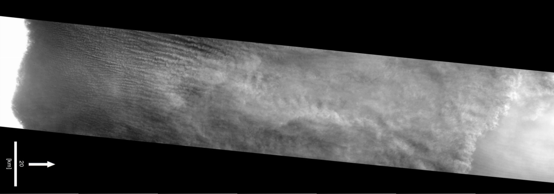
The Cassini spacecraft is in orbit around Saturn, and occasionally flies close to one of its many icy moons. Because of specially designed instruments on Cassini, the surface of Saturn’s largest moon, Titan, enshrouded in a thick, hydrocarbon haze-rich atmosphere, has been observed for the first time by this spacecraft.
Cassini RADAR SAR image is north up, with resolution ~300 m. RADAR illumination direction and inclination angle is indicated by the open arrow. Image courtesy of the NASA Cassini Project.
Posted by Mary Bourke, Geography, Trinity College, Dublin, Ireland.
(Re-posted from IAG Image of the Month, June, 2007)
Both Earth and Mars have atmospheres that can mobilize particles to form sand dunes. This image is from the caldera of an inactive Volcano (Nili Patera) on Mars. The steep avalanche face on the downwind side of the dunes indicates wind direction (see arrow). There are several types of sand dunes in this image, some of which have not been previously recognized on Mars.(more…)