Quantification of ice blockfall activity at a north polar scarp on Mars

Post contributed by Ernst Hauber and Lida Fanara, Institute of Planetary Research, German Aerospace Center (DLR), Berlin, Germany.

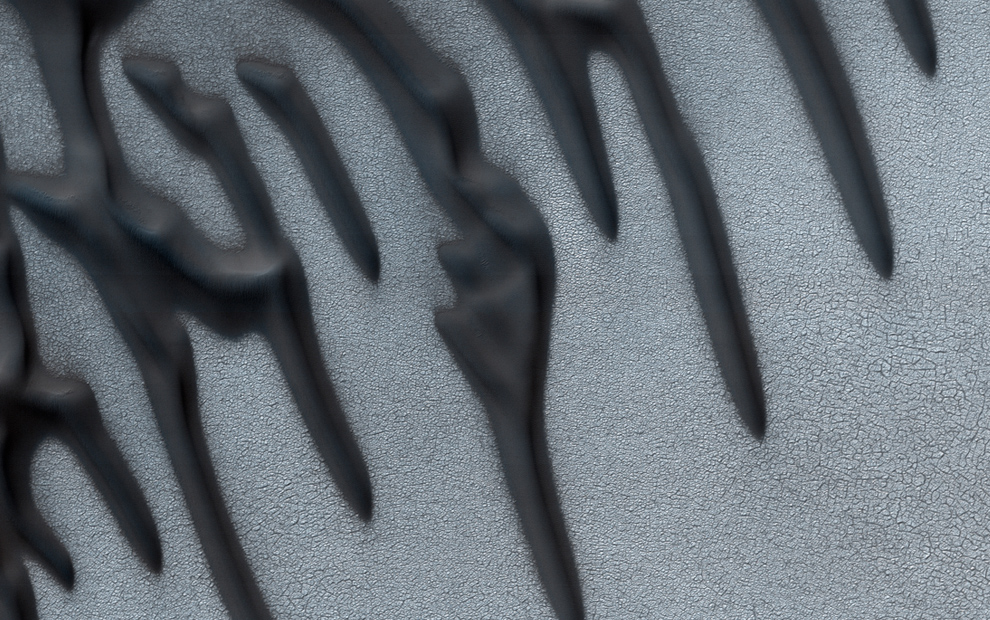
Mars is an active planet, and several processes are currently shaping its surface. Among those, gravity-driven mass wasting produces surface changes that can be quantified in image data acquired before and after discrete events. As such changes are typically small in their spatial dimensions, the prime dataset to recognize them are pairs of HiRISE images (High Resolution Imaging Science Experiment; McEwen et al., 2007), with scales of ~25-50 cm/px. The manual identification of surface changes in these huge images (a single HiRISE image can have a size of several Gigabytes) is challenging, however, and requires significant efforts. In order to circumvent this massive demand on human resources while yet taking advantage of all images, automated methods need to be developed. Here we show an example of such methods which was applied to ice block falls at a steep cliff in Mars` north polar region.

PGIM.Figure_01

Image 1: Block fall at a scarp on the north polar region of Mars near 83.796°N and 236.088°E. (a) «before» image acquired at 06 May 2014 (HiRISE image ESP_036453_2640). (b) «after» image acquired at 25 December 2019, showing a cluster of blocks that was displaced from the scarp to the right (east) (ESP_062866_2640). North is up in both images, scale bar is 100 m.
(more…)

Blocks fragmented in place on the Moon

Post by Dr. O. Ruesch, European Space and Technology Center, European Space Agency (ESA), the Netherlands.

A fragmented block is referred to a cluster of fragments formed by the disruption of a parent block. The identification of such features on planetary surfaces is possible due to the minor spatial dispersion of the fragments away from the parent block. This morphology is to be distinguished from clusters of fragments formed by mass wasting like rockfall or disintegration during block rolldown. Observations of fragmented blocks have been reported on almost every rocky planetary body where images captured by orbital and surface craft resolved features in sufficient spatial detail. Despite the fact that disrupted blocks can reveal important clues on the formation process of soil (regolith) on planetary surfaces, they have started to receive attention only in recent years.

On the airless surface of the Moon, fragmented blocks display a wide range of morphologies (Images 1 and 2). In general, the configurations of the fragments can be described by a continuum from highly catastrophic to sub-catastrophic. Image 1 shows an example of a catastrophic fragmentation where the number and size of the fragments indicate that the parent block was much larger than the largest fragment. The radial pattern formed by small fragments and brighter areas is diagnostic of disruption by a meteoroid impact.

image_1

Image 1. Example of a block fragmented catastrophically near crater Copernicus on the Moon, where the largest fragmented in considerable smaller than the original parent block. LROC/NAC image M127063668LE. http://bit.ly/2mAl0CB

(more…)

The Moon’s Rolling Stones

Post by Valentin Bickel, PhD student, Department of Earth Sciences, ETH Zurich, CH & Department Planets and Comets, Max Planck Institute for Solar System Research, GER.

One of the most intriguing objects on the surface of the Moon are the “rolling stones”, also known as lunar rockfalls or rolling boulders (Image 1). These boulders are abundant all over the Moon and have sizes that range from a couple of meters to several 10s of meters. Lunar boulders are believed to be displaced by moonquakes or impacts and can carve tracks with lengths that range from a couple of meters to several kilometers (Image 1; Xiao et al., 2013; Kumar et al., 2016). Besides their value for geomorphological analyses, these boulder tracks provide insights into the mechanical behavior and the trafficability of the lunar “soil”, the regolith (Bickel et al., 2019).

IAG_1

Image 1: A number of large and small boulders with tracks at the bottom of a lunar slope. The analysis of tracks provides insights about the mechanical properties of the regolith and is performed using high-resolution satellite imagery, taken by NASA’s Lunar Reconnaissance Orbiter Narrow Angle Camera (NAC).  Detail of NAC Image M113934119LC.

(more…)

  • Enter your email address to follow this blog and receive notifications of new posts by email.

  • Io

  • Blog Stats

    • 192,914 hits