Transient flow of water on Vesta suggested by gullies and lobate deposits.

Post contributed by Jennifer Scully, Dept. of Earth, Planetary & Space Sciences, University of California Los Angeles

Vesta is the second most massive asteroid in the asteroid belt, with a mean diameter of 526 km (e.g. Russell et al., 2012). High resolution images from the Dawn Mission have detected curvilinear and linera gully forms and lobate deposits in craters and on steep slopes on its surface (Scully et al., 2015).
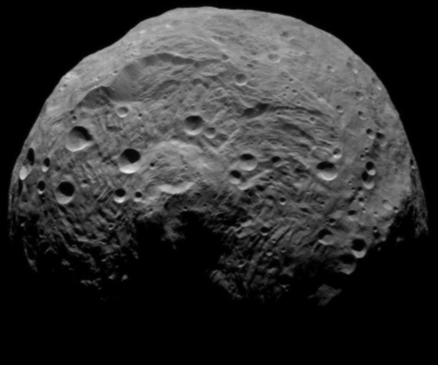
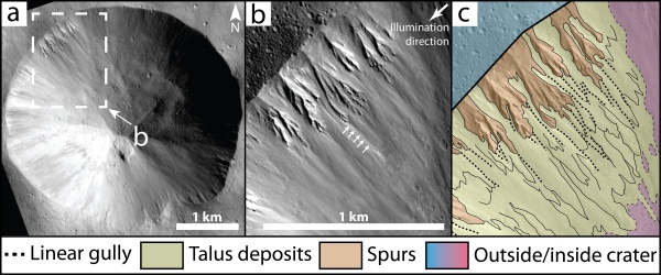
Image 1: (a) Fonteia crater, which contains linear gullies. (b) Unmapped version and (c) mapped version of linear gullies. White arrows highlight an example linear gully in (b).

Image 1: (a) Fonteia crater, which contains linear gullies. (b) Unmapped version and (c) mapped version of linear gullies. White arrows highlight an example linear gully in (b).

(more…)

Geomorphic activity on asteroid Vesta

Post by Prof. Dr. Ralf Jaumann and Dr. Mary C. Bourke,

German Aerospace Center, Berlin, Germany. 

Department of Geography, Trinity College Dublin, Ireland.

The NASA Dawn spacecraft was launched in September 2007 to characterize the conditions and processes of the solar system’s earliest epoch by investigating in detail two of the largest protoplanets remaining intact since their formation. Ceres and Vesta reside in the extensive zone between Mars and Jupiter together with many other smaller bodies, called the asteroid belt. Each has followed a very different evolutionary path constrained by the diversity of processes that operated during the first few million years of solar system evolution. The Dawn mission entered orbit around Vesta on 16 July 2011 for a one-year exploration and left orbit on 5 September 2012 heading towards Ceres.

Image A. A composite digital terrain model, and high resolution albedo mosaic and imbedded color channels of three cratres on the surface of Vesta. The image is composed of many individual photographs taken between October and December 2011 by Dawn’s framing camera during the high-altitude mapping orbit, at about 680 kilometers above Vesta’s surface. The image is centered on ~ 13° north latitude and ~ 195° eastern longitude. South is to the top of the image. Image credit: NASA/JPL-Caltech/UCLA/MPS/DLR/IDA.

(more…)

  • Enter your email address to follow this blog and receive notifications of new posts by email.

  • Io

  • Blog Stats

    • 192,913 hits