Post contributed by Dr Anna Grau Galofre, Laboratoire de Planetologie et Geosciences, CNRS UMR 6112, Nantes Universite, Universite d’Angers, Le Mans Universite, France.
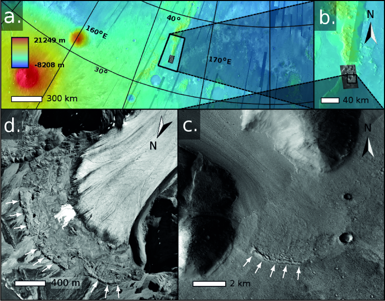
Glaciers, ice sheets, and ice masses in general, are both agents of landscape evolution and a part of the landscape itself, when considered at human time scales, with surfaces that evolve and record changes in environmental conditions. The ages of glaciers and ice sheets on Earth, which range from thousands to millions of years, dwarf in comparison with the ages of debris-covered ice masses on Mars. Debris-covered martian ice deposits range up to hundreds of millions of years old, perhaps approaching 1 billion years old in some locations. Image 1 shows complex patterns on the surface of a debris-covered glacier on Mars. Terrestrial glacial surface deformation patterns can record changes in environmental conditions, which are also captured in the variability in chemistry and crystal structure seen in their internal stratigraphy. The morphology of a glacier surface, for example, may reflect episodes of warmer climate, and therefore enhanced ice flow; banding patterns may reflect periodic changes in the mass balance of ice accumulation and ice loss; and crevasses may reflect episodes when ice flowed relatively fast and fractured. The surface morphology of glaciers and debris-covered ice deposits can thus help us learn about the history of climate on Earth and Mars.
Image 1. Surface banding patterns on a debris-covered, cold based ice deposit (called a ‘lobate debris apron’) flowing down a canyon wall in Reull Vallis, Mars. Extract from CaSSIS image MY34_005511_224 (footprint width is 9 km). Image credit: ESA/CaSSIS.
(more…)