On Mars, dust avalanches triggered by major marsquakes

Post contributed by Dr. A. Lucas. Research Scientist, Institut de physique du globe de Paris, France

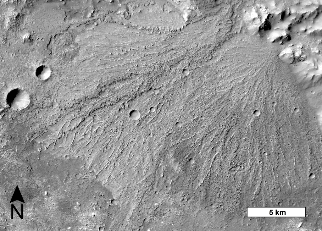
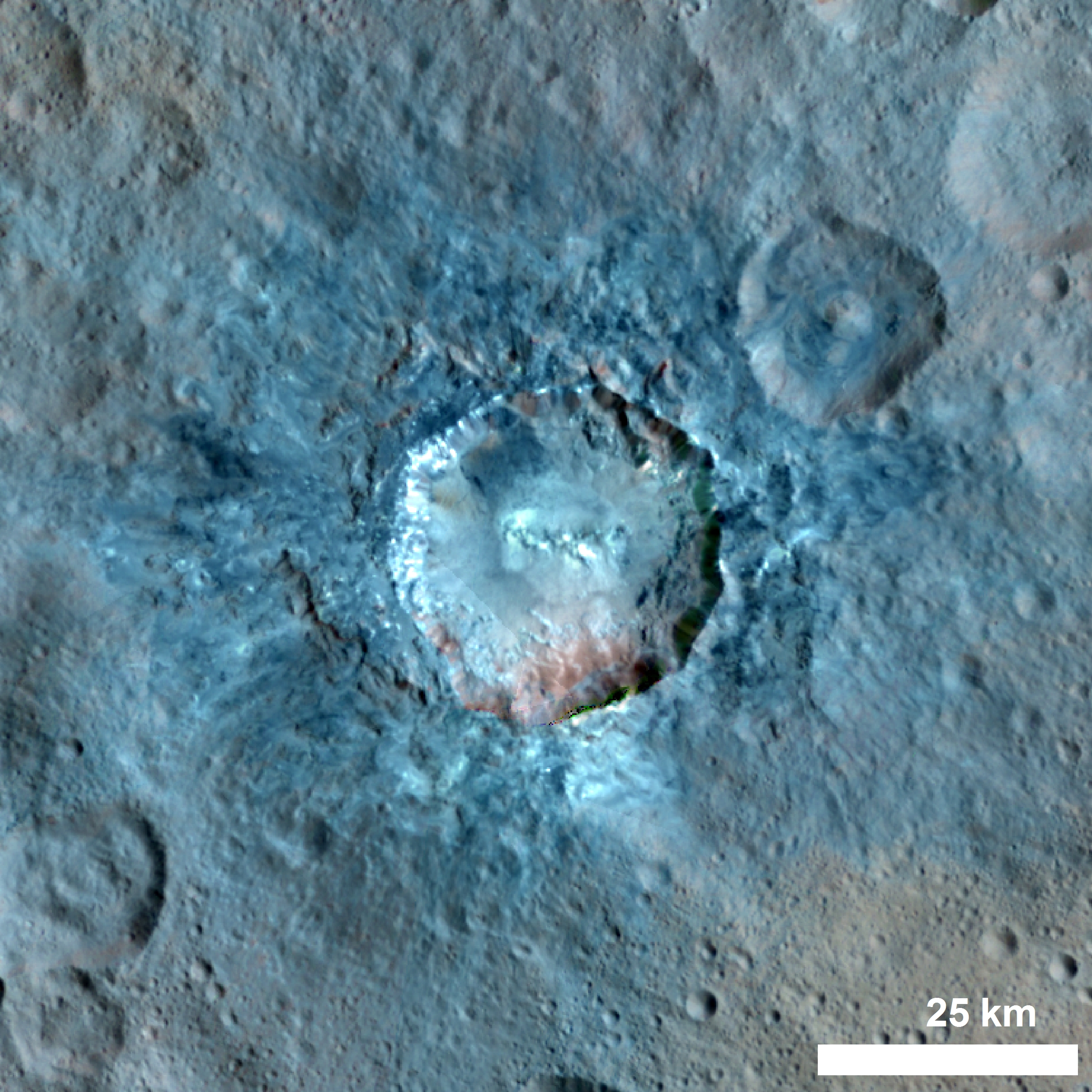
A detailed analysis of both orbital and seismological data associated to the two largest seismic events recorded during the Nasa InSight mission to Mars (operational from the end of 2018 to the end of 2022), have been done by a team of researchers from the IPGP (Université Paris Cité / CNRS) and their colleagues. They have spotted a clear increase in the number of dust avalanches around the two epicenters of both quakes. The first seismic event was caused by an impactor hitting the Martian surface. The second seismic event was the largest marsquake ever recorded. This finding sheds light on how endogenous and exogenous processes can currently shape the surface of Mars and trigger active mass wasting.

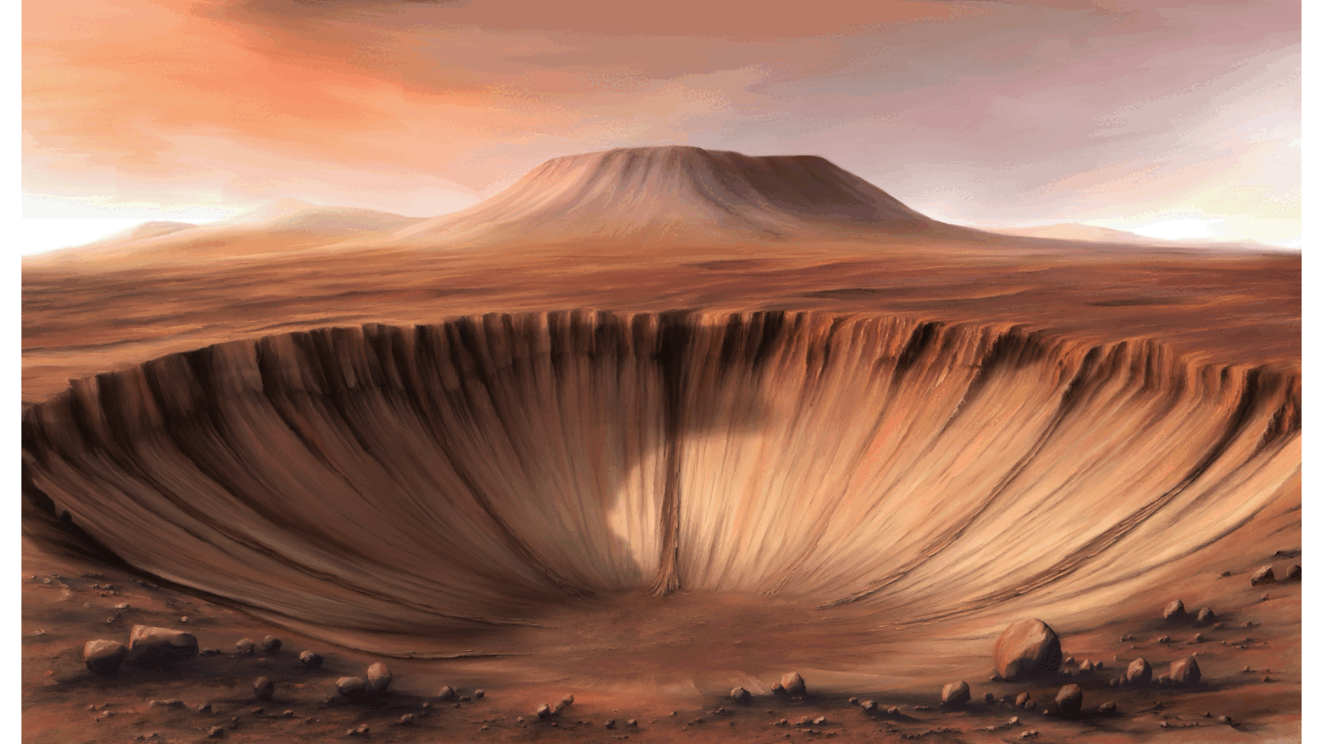
Image 1: . Illustration of seismic waves triggering dust avalanches in an impact crater. © Nicolas Sarter for IPGP (an animation version is also available with permission to use: https://www.ipgp.fr/wp-content/uploads/2024/01/Animation_avalanche.gif, credits are © Nicolas Sarter (illustration) / Antoine Lucas (animation) )

(more…)

Grabens, evidence for widespread recent tectonism on Mercury

Post contributed by Ben Man, The Open University @AstroBenjamin

Mercury is a contracting world as evidenced by the abundance of shortening structures observed across the surface of the planet (Image 1). Global contraction as a result of secular cooling of the planetary interior is most likely responsible for widespread compressional tectonism with shortening structures seen cutting all surface materials at all latitudes and longitudes. Shortening structures are accepted as the surface manifestation of thrust faults and folding. Grabens, such as those observed in the images (Image 1-3), are secondary structures found on top of parent shortening structures. The presence of these grabens provide evidence for recent widespread tectonism on Mercury, confirming that global contraction is ongoing.

Image 1: Aspect view of Alpha Crucis Rūpes with horst and grabens present in the foreground of the image. Alpha Crucis Rūpes is located in H09 Eminescu, an equatorial quadrangle. The image is comprised of the H09 south east high incidence west mosaic tile and five individual narrow-angle camera frames (EN0231136925M, EN0231136927M, EN0231136960M, EN0231136962M, EN0231136998M). The image has not been vertically exaggerated and the scale bar is computed for the centre of the image. Image source: NASA/JHUAPL/CIW made by Benjamin Man. Image frames and mosaic tiles are available from NASA’s Planetary Data System Geosciences Node (https://pds-geosciences.wustl.edu/) and the Cartography and Imaging Sciences Node (https://pds-imaging.jpl.nasa.gov/).

(more…)

Geological and topographical analysis of Anshar Sulcus, Ganymede: Implications for grooved terrain formation

Post contributed by Dr. Mafalda Ianiri, University G. d’Annunzio Chieti- Pescara, International Research School of Planetary Sciences.

The icy surface of Ganymede, the largest satellite of the Jupiter system, presents two dominant terrains characterized by different albedo: the dark and light terrains (Image 1). The dark terrains are composed of dark, albedo-heterogeneous material, modified by surficial processes, such as sublimation, mass wasting, and sputtering (ejection and redistribution of molecules across the Ganymede’s surface, which is caused by the energy transferred to the surface through the impact of particles from Jupiter’s magnetosphere; Pappalardo et al., 2004). The dark terrains are highly cratered, preserving the relicts of vast global-scale sets of concentrically arranged structures, called furrows (Pappalardo et al., 2004). The younger light terrains are more extensive than the dark terrains, covering approximately 64% of Ganymede’s surface (Patterson et al., 2010). Light terrains are pervasively crossed by sets of sub-parallel, closely spaced ridges and troughs, referred to as grooves (Patterson et al., 2010; Pappalardo et al., 2004).

Image 1: Geomorphological map of Anshar Sulcus region of Ganymede based on the 2865_r and 2878_r high resolution images captured by Galileo SSI camera. (Credit: Ianiri et al., 2023).

(more…)

Flow deposits on Mercury – Impact ejecta flows or landslides?

Post contributed by Alistair Blance, The Open University, UK

During an impact on Mercury’s surface, material is ejected from the forming impact crater. As Mercury has only a tenuous atmosphere, ejected material travels predominantly ballistically, creating an ejecta deposit around the crater that thins gradually with increasing distance. However, large deposits emplaced by ground-hugging flows can be found around some impact craters on Mercury (Image 1). Evidence for flow includes material being diverted around obstacles, a steep edge or distal ridge at deposit margins, and a lobate shape to several examples. Some flow deposits extend outwards around a whole crater, but often they are confined within topographic lows adjacent to the crater. To help assess the origin of these features, it is useful to compare them to similar features across the Solar System. This comparison may also indicate how differences between the planets can influence the development of flows around craters.

Image 1: Flow deposits around craters on Mercury. Deposit boundaries indicated with red triangles. (A) Flow deposit extending from the central crater into an underlying crater in the top right of the image. Steep margins with a lobate shape suggest emplacement by flow. Image taken from MESSENGER MDIS BDR Global Basemap. (B) A crater with two sections of flow deposit extending into the underlying crater in the bottom right of the image. Image taken from MESSENGER MDIS frame EW0260906588G. (C) Sketch map of the image in B. Shows the two sections of flow deposit in red, with hypothesised direction of emplacement shown with red arrows. The deposit appears to have been diverted around a central peak within the underlying crater, providing evidence for emplacement via ground-hugging flow.

(more…)

BepiColombo: the challenge is at dawn

Post contributed by Dr Valentina Galluzzi – National Institute of Astrophysics, Institute for Space Astrophysics and Planetology (INAF-IAPS), Italy.

The ESA/JAXA BepiColombo spacecraft is on a long journey into orbit around Mercury. This journey includes six flybys of the planet before orbital insertion in 2025. On 23 June 2022, BepiColombo accomplished its second flyby of Mercury by approaching the planet as close as 200 km from the surface. Unfortunately, this happened when night shadows were still hiding the surface from sight. It was just 5 minutes after closest approach that the Monitoring Cameras (M-CAMs, three in total) mounted on the BepiColombo’s Mercury Transfer Module (MTM) could start taking the first snapshots of the planet with enough light. This caused the pictures to show dramatic sunrise shadows along the terminator. One of the first regions to be imaged was the Eminescu area of Mercury, as seen in Image 1.

Image 1: Composite image of the Eminescu region of Mercury made with BepiColombo/MTM M-CAM#2 “Image 02” taken during BepiColombo’s second Mercury flyby (credits: ESA) overlain by MESSENGER/MDIS enhanced colors (Denevi et al., 2018). Some spacecraft parts are visible near the frame margins. North is to the left. For scale reference, Izquierdo crater diameter is about 150 km (see Image 2).

In this picture, the shadow-enhanced morphology comes from the original M-CAM#2 frame taken at 09:24 UTC. By georeferencing the original M-CAM photo onto the Mercury’s spatial frame (Galluzzi et al., 2022) it was possible to overlay terrain color using the MESSENGER/MDIS enhanced color mosaic (Denevi et al., 2018). The composite image helps to highlight the terrain diversity in this area, from the yellowish young smooth plains to the dark blue and rougher intercrater plains.

(more…)

The global distribution of alluvial fans on Mars

Post contributed by Dr Alex Morgan, Planetary Science Institute, USA

Alluvial fans are sedimentary deposits that form at the base of mountain fronts as a channel exits a steep, confined valley onto more gently sloped and unconfined terrain (Image 1). The channel loses its ability to transport sediment due to the reduction in slope and the lateral expansion of flow, and over time sediment is deposited into a semi-conical shape. The effects of water on a landscape are the most unambiguous markers of past climatic environment, and the distribution of alluvial fans provides a record of where and when liquid water was capable of transporting sediment on Mars in the past. Furthermore, as depositional features in close proximity with their sediment sources, alluvial fans preserve a record of environmental changes that occurred while sediment was being transported and deposited. In this study, we leveraged high resolution images from the CTX camera on Mars Reconnaissance Orbiter, which cover the entire surface of Mars, to conduct a global survey for fan-shaped sedimentary landforms across the martian surface and explore their implications for environmental change.

Image 1: A large alluvial fan in Harris crater, centered on 21.5°S, 67°E. The down-fan-trending ridges are interpreted to be paleochannels now in inverted relief due to preferential erosion of finer overbank deposits. This particular fan exhibits evidence for multiple episodes of sedimentation (Williams et al., 2011). CTX image G02_019160_1580_XN_22S292W.

(more…)

Regional Impact Crater Mapping of Saturn’s moon Dione

Post contributed by Dr. Sierra Ferguson. Postdoctoral Researcher, Department of Space Studies, Southwest Research Institute, Boulder Colorado, USA.

Dione is one of Saturn’s many photogenic “mid-sized” icy moons, first visited by the Voyager mission in 1980. Most well-known for its system of bright scarps/troughs on the trailing hemisphere of the moon (aka the “wispy terrain”, Image 1), Dione is host to a wide range of interesting surface and subsurface features such as impact craters, tectonics, and potentially a subsurface ocean. Models of the formation of the Saturnian satellites have frequently placed their formation ages at ~ 4 billion years ago, roughly around the same time that Saturn itself formed. However, recent modeling of the orbital dynamics of the system have shown that the inner moons (Mimas, Enceladus, Tethys, Dione, and Rhea) may in fact be much younger, with the youngest potential formation age only 100 million years ago. One way to examine the surface ages, and the potential formation age of Dione, is through the analysis of impact crater distributions. We utilized images from NASA’s Cassini spacecraft to examine the sources of craters on Dione and what they mean for the ages of Saturn’s satellites and the evolution of Dione’s surface (Ferguson et al., 2022b).

Impact craters are very common geologic feature on planetary surfaces. We can analyze their distributions to examine their origins, and model the surface age of a mapped region. A lack of impact craters is often interpreted to be a result of crater erasure by geologic resurfacing process (i.e., volcanism, mass wasting, additional cratering). By mapping the observed craters on Dione, we are able to characterize the bombardment environment at Saturn as well as the modification history of Dione’s surface.

Image 1: Cassini ISS-NAC image of Dione’s wispy terrain area. This image provides context for the craters on the surface as well as the relationship of the craters to the tectonic features observed on the surface. Image credit NASA/JPL/SSI, PIA 18327 (https://photojournal.jpl.nasa.gov/catalog/PIA18327)

(more…)

Inlet valleys that cut into crater rims on Mars.

Post contributed by Emily Bamber (PhD Candidate), Jackson School of Geoscience, University of Texas at Austin

Impact craters are a common feature of the surface of Mars and other planetary bodies. Impact craters are formed by the force of an asteroid or comet colliding with the surface of a planet. This collision excavates a bowl-shaped depression and causes uplift, deformation and deposition of excavated material to form a crater rim, which can rise hundreds of meters above the surroundings (for a crater on the scale of tens of kilometers in diameter). However, some of Mars’ impact craters stand out from their counterparts on other rocky planets and moons because they have been affected by the action of erosion by liquid water. In comparison to the Moon, Mars’ craters deviate much more from their original geometries, but perhaps more strikingly, more than 400 craters on Mars’ surface have an inlet valley (Image 1); a valley which starts from outside the crater and crosses the rim crest (e.g. Cabrol & Grin, 1999; Goudge et al., 2016). Although no substantial liquid water currently flows on Mars today, the preserved valleys likely delivered water from a crater’s surroundings to the crater interior, at some time in the distant past. Therefore, their formation could give clues to Mars’ watery past.

Image 1: An impact crater on Mars, at 16.2°N, 53.2°W with a high-standing crater rim around its circumference. To the south of the crater, there is an inlet valley that crosses the rim divide, with two wide tributaries. The valleys are now dry, but liquid water in Mars’ past likely incised them. The crater does not have an outlet valley (where water may have exited the crater in a through-flowing system). Background is a CTX DEM (from the stereo pair B21_017806_1955 – B21_017951_1955), HRSC DEM h2277_0000 and global MOLA DEM, overlain on CTX image B21_017806_1955 and THEMIS global IR mosaic.

(more…)

Ice Deposits Revealed by Radar Within Craters on Mercury

Post contributed by Dr. Edgard G. Rivera-Valentín, Lunar and Planetary Institute, Universities Space Research Association.

Although its surface can reach 800°F (427°C), some of Mercury’s craters conceal vast ice deposits that, in a sense, “sparkle” in the light of radar (Image 1). The so-called radar bright features were first identified in 1992 using ground-based observatories, in particular the Arecibo Observatory in Puerto Rico, which provided magnificent views down to craters tens-of-kilometers in diameter all the way from Earth. The ice lies within craters whose morphology and location results in areas that do not receive direct sunlight (i.e., permanently shadowed regions). This allows for the low temperatures needed to retain ice over millions of years.

Image 1: Radar image of Mercury’s north polar terrain (> 75°N) in polar stereographic projection. The five notable craters, Chesterton (88.5°N, 126.9°W), Tolkien (88.8°N, 211.1°W), Tryggvadóttir (89.6°N, 171.6°W), Kandinsky (87.9°N, 281.2°W), and Prokofiev (85.7°N, 297.1°W) are labeled. Radar backscatter is noted in grayscale from black (below noise levels) to white (high backscatter). All bright areas are radar bright features, which are located within craters that have permanently shadowed regions. These are the locations of ice deposits on Mercury. For scaling reference, Chesterton crater has a diameter of 37.2 km. Image credit: Figure 2 in Rivera-Valentín et al. (2022) PSJ 3,62.

The discovery of the radar bright features at Mercury’s poles was one of the motivators of NASA’s MESSENGER (Mercury Surface, Space Environment, Geochemistry, and Ranging) mission, which studied Mercury between 2011 – 2015. That is because although the radar scattering properties of the features were reminiscent of observations of the Martian polar layered ice deposits, as well as of the icy moons of Jupiter, they alone did not uniquely indicate the presence of water ice. The detailed studies by MESSENGER along with the earlier radar observations together now strongly suggest deposits of water ice. This is due to their location, evidence from high resolution and long exposure imaging, and measurements of epithermal and fast neutron fluxes.

(more…)

Evidence of Tectono-Volcanism in Arabia Terra, Mars

Post contributed by Alka Rani, Planetary Science Division, Physical Research Laboratory, India

Cones are common landforms arising from volcanism on Earth and can be observed on other terrestrial planets. Mars hosts small conical hills known as mounds – these positive relief features have been reported in several locations over the Martian surface (Brož et al., 2017; Hemmi & Miyamoto, 2017) and inside craters such as Firsoff, Becquerel, Kotido, and Crommelin in southwestern Arabia Terra (cf. McNeil et al., 2021; Pondrelli et al. 2015). Various processes have been proposed for the development of mounds on Mars, including mud volcanism, monogenetic or small-scale volcanism, preferential erosion of sedimentary units, and diapir-like discharge of sediment-laden fluid. Sedimentary origins have been previously hypothesized for the mounds found on crater floors (Pondrelli et al., 2011; Pondrelli et al. 2015). In that context, we identify previously unrecognized evidence of intrusive igneous process at the center of an unnamed ∼85-km diameter floor-fractured crater (FFC, Bamberg et al., 2014) in North-Central Arabia Terra (Image 1). We consider whether the observed geomorphic features are related to impact-induced volcanism or to regional intrusive activity during the late Noachian to early Hesperian periods of Mars (~3.6 Ga; Rani et al., 2021).

Image 1: Thermal Emission Imaging System daytime Infrared image mosaic of the studied Floor-Fractured Crater in the eastern Arabia Terra region, overlain by color-coded Mars Orbiter Laser Altimeter and High-Resolution Stereo Camera elevation map. The black box in the center of the crater shows the location of the mounds and ridges (See Image 2). The location of the crater is marked by a yellow star in the inset global map of Mars. Image credits: HRSC-MOLA Blended DEM Global 200m v2, USGS/DLR/NASA/Goddard Space Flight Center. THEMIS-IR Day Global Mosaic 100m v12, THEMIS team/ASU

(more…)

Antipodal Terrains on Pluto

Post contributed by C. Adeene Denton, Department of Earth, Atmospheric, and Planetary Sciences, Purdue University, USA.

Antipodal terrains are unusual regions of hilly, lineated, or otherwise disrupted terrain that are on the direct opposite side of planetary bodies to large impact basins. These mysterious terrains have been observed at the antipodes to the Caloris basin on Mercury and the Imbrium basin on the Moon, where their formation is considered to be indicative both of the impact’s size and the specificities of the planetary body’s interior structure. Recent revisiting of data from the New Horizons spacecraft revealed an unusual region of disrupted and lineated terrain on Pluto’s far side that is roughly antipodal to the massive Sputnik Planitia basin, the feature sometimes referred to as “Pluto’s Heart” (Image 1). If the lineated terrain is indeed connected to the large impact believed to have formed Sputnik Planitia, then the two geologic features offer a new and unusual way to probe Pluto’s interior: seismology through giant impact.

Image 1: Comparison of Pluto’s nearside (left) and farside (right) with Sputnik Planitia and its proposed antipodal terrain indicated. The location of Image 3 is also indicated. Images modified from full-scale planetary images taken by the New Horizons spacecraft, via NASA/JHUAPL/SWRI.

(more…)

Polygonal Impact Craters on Miranda, Charon, and Dione

Post contributed by Dr. Chloe B. Beddingfield, The SETI Institute and NASA Ames Research Center

Some impact craters are classified as polygonal impact craters (PICs), which have at least one straight rim segment, as shown in Image 1. The morphologies of PICs are shaped by pre-existing, sub-vertical structures in the target material, such as normal and strike-slip faults, joint sets, and lithologic boundaries. Because the straight rim segments of PICs only form where pre-existing structures are present, PIC morphologies can be used to analyze fractures that are buried by regolith or too small to be seen in available spacecraft images. On the icy Uranian moon Miranda, PICs are widespread across its southern hemisphere, which was imaged by the Imaging Science System (ISS) onboard the Voyager 2 spacecraft. Some of these PICs reveal previously undetected fractures that suggest Miranda has experienced multiple periods of tectonic activity.

Image 1: Examples of two PICs identified on the Uranian moon Miranda. Black arrows indicate the straight rims of these PICs. The Voyager 2 ISS image mosaic shown here includes the following images, from top to bottom: c2684620 (light blue box), c2684629, c2684617 (dark blue box).

(more…)

Superposed glaciers on Mars: what, where, when, and why?

Post contributed by Adam J. Hepburn, Department of Geography and Earth Sciences, Aberystwyth University, UK.

Mars hosts abundant glacier-like landforms throughout its mid-latitudes, the presence of which necessitates major shifts in climate relative to present conditions. These ice-rich viscous flow features (VFFs) are typically found in coalescing, size-hierarchical systems whereby lower-order glacier-like forms (GLFs; ~5 km long) flow from alcoves and merge with higher-order lineated valley fill (LVF; 100s of km long). Several larger VFFs have been dated previously, indicating Mars underwent glaciation in the past several hundred million years, during the late Amazonian epoch.  However, several authors have noted examples of GLFs flowing onto, rather than into, LVFs (Image 1), and hypothesised that these may correspond to a more recent phase of glacial activity. We used crater dating to ascertain that—in addition to the earlier phase of widespread regional glaciation—these superposed GLFs (SGLFs) were formed following at least two major cycles of more recent alpine glaciation, the latter of which ended ~2 million years ago.

Image 1: Superposed glacier-like form (SGLF) flowing onto the underlying viscous flow feature (underlying VFF), in the Protonilus Mensae region of Mars. (A–B) North-up orientated HiRISE image (ESP_018857_2225) image of an SGLF (light blue) emerging from an alcove and flowing onto lineated valley fill (dark blue). Approximate location of image centre is 42.23◦ N, 50.53◦ E. Reproduced from Hepburn et al, 2020.

(more…)

Impact Crater Degradation on Mercury

Post by Mallory Kinczyk, PhD candidate, Department of Marine, Earth, and Atmospheric Sciences, North Carolina State University

The formation of impact craters may be the most ubiquitous exogenic surface process in the Solar System. These craters take on many shapes and sizes and can hint at underlying rock types, tell us about the nature of the impactor, and can shed light on the body’s geological history. Even on bodies without atmospheres, erosive forces are at play, changing the crater shape through time via processes such as seismic shaking and disruption from debris thrown outward by subsequent, nearby impacts. Because Mercury is the only terrestrial planet without an atmosphere, it maintains a unique snapshot of the inner Solar System’s impactor population (Image 1) and, in turn, can shed light onto Earth’s own geological history.

converted PNM file

Image 1: View of Mercury from the MESSENGER spacecraft, which orbited Mercury between 2011 and 2015 (Image PIA17280). A variety of impact crater sizes and shapes are evident from very fresh craters to subdued to almost completely obliterated crater forms. Bach crater (arrow) hosts a well-defined central peak ring, but its subdued form indicates that it has been disrupted by subsequent craters. Image Credit: NASA/Johns Hopkins University Applied Physics Laboratory/Carnegie Institution of Washington.

(more…)

Degradation of Titan’s impact craters

Post by Joshua E. Hedgepeth, PhD student, Centre for Planetary Science and Exploration, University of Western Ontario, Canada.

Discovered by Huygens in 1656 (Huygens, 1656), the surface of Titan was obscured by its atmosphere for centuries (Campbell, 2003; Smith et al., 1996; Muhleman et al., 1995, 1990; Kuiper, 1944). In 2004, we finally obtained high resolution images of the surface with Cassini RADAR. Cassini was equipped with a Ku-band (2.17 cm λ) radar instrument with 5 beams for collecting data (Elachi et al., 2004; Stofan et al., 2012). The long wavelength band was able to penetrate Titan’s thick haze to perform radiometry, scatterometry, altimetry and synthetic aperture radar (SAR) imaging of the surface. The SAR mode captured the highest resolution images of the surface of Titan, as high as 175 meters per pixel (Elachi et al., 2004; Lopes et al., 2010). While this may not be as high resolution as the images we have of other moons, it is high enough to obtain some spectacular images. In this blog we have a detailed look at the craters on the surface of Titan.

selk

Image 1: Selk crater (D=84 km) located at 199.1, 6.9 latitude and longitude. The dark crater floor is representative of the smooth material, and around it is the bright rough ejecta material.

(more…)

Haulani crater on the dwarf planet Ceres

Posted by Dr. Katrin Krohn, German Aerospace Center, Institute of Planetary Research

Haulani is one of the most prominent features on Ceres. The impact crater has bright interior and extensive ejecta with farranging crater rays of about 160 km to 490 km. Haulani shows an overall smooth bright crater floor with flow features and some cracks in the floor’s northwestern part, parallel to the impact crater rim. This crater exhibits a hummocky elongated mountainous ridge in the central part of the crater with flows running downslope the ridge crest ponding toward mass-wasting deposits of the rim. Pits occur on the crater floor and in parts of Haulani’s ejecta. Since Ceres shows evidence of a volatile-rich crust, the pits are likely due to rapid post-impact outgassing of hydrated salts or ground ice.

figure1_haulani_color

Image 1: Color mosaic of Haulani, showing the diverse morphology of the crater.

(more…)

Phobos Grooves from Rolling Boulders

Post by Kenneth R. Ramsley, Department of Earth, Environmental and Planetary Sciences, Brown University.

All but one region of Phobos, the largest moon of Mars, is covered by hundreds of valley-like features, usually described as grooves. Most grooves are ~80 to ~200 meters wide and are found in groups of generally parallel members, or families [see Image 1]. Impact craters typically produce slow-moving boulders, and on Phobos there would be little gravity to halt their motions. Did boulders rolling across the surface of Phobos produce the grooves? To answer this question, using a computer model to calculate the fate of rolling boulders, we compare their motions to the geomorphology of the grooves.

Image 1 - Viking Image

Image 1: Dominated by Stickney Crater, a feature nearly half the radius of the moon itself, Phobos is the larger of the two moons of Mars (average diameter, 22 kilometers). Mostly covered in valley-like features, planetary scientists have struggled for more than 40 years to explain the grooves of Phobos (Viking Project, JPL, NASA; Image mosaic by Edwin V. Bell II NSSDC/Raytheon ITSS).

(more…)

Is the Xanadu region on Titan an impact basin?

Post by Dr. Mirjam Langhans, GFZ German Research Centre for Geosciences, Helmholtz Centre Potsdam, Germany.

The surface of Titan, Saturn’s largest moon, is subject of great geologic interest, particularly since the arrival of Cassini/Huygens mission in the Saturnian System. Titan’s largest distinct and highly reflective surface feature, named Xanadu, is located close to the equator. The image depicts Xanadu in full extension with a rich diversity of geologic landforms, such as fluvial valleys, mountain ridges and impact craters. Despite the high volume of image data in this region, the geologic history behind Xanadu remains enigmatic to this day.

Geomorphologic map of Xanadu. Data: Cassini SAR data, source: (http://pds-imaging.jpl.nasa.gov/portal/cassini_mission.html). background: Cassini-ISS, source: (http://pds-imaging.jpl.nasa.gov/portal/cassini_mission.html). Inner and outer boundary of the Xanadu Circular Feature (XCF) are highlighted at Western Xanadu (black lines, according to Brown et al. (2011)). Green dots: impact craters listed in Wood et al. (2010) and Neish & Lorenz (2012), red dots: potential impact craters. Fluvial channels are delineated in blue. Dark green: lineations seen in mountain ranges, from Radebaugh et al. (2011). Light green: lineations in mountain ranges (Langhans et al. 2013).

Geomorphologic map of Xanadu. Data: Cassini SAR data, source: (http://pds-imaging.jpl.nasa.gov/portal/cassini_mission.html). background: Cassini-ISS, source: (http://pds-imaging.jpl.nasa.gov/portal/cassini_mission.html). Inner and outer boundary of the Xanadu Circular Feature (XCF) are highlighted at Western Xanadu (black lines, according to Brown et al. (2011)). Green dots: impact craters listed in Wood et al. (2010) and Neish & Lorenz (2012), red dots: potential impact craters. Fluvial channels are delineated in blue. Dark green: lineations seen in mountain ranges, from Radebaugh et al. (2011). Light green: lineations in mountain ranges (Langhans et al. 2013).

(more…)

Geomorphic activity on asteroid Vesta

Post by Prof. Dr. Ralf Jaumann and Dr. Mary C. Bourke,

German Aerospace Center, Berlin, Germany. 

Department of Geography, Trinity College Dublin, Ireland.

The NASA Dawn spacecraft was launched in September 2007 to characterize the conditions and processes of the solar system’s earliest epoch by investigating in detail two of the largest protoplanets remaining intact since their formation. Ceres and Vesta reside in the extensive zone between Mars and Jupiter together with many other smaller bodies, called the asteroid belt. Each has followed a very different evolutionary path constrained by the diversity of processes that operated during the first few million years of solar system evolution. The Dawn mission entered orbit around Vesta on 16 July 2011 for a one-year exploration and left orbit on 5 September 2012 heading towards Ceres.

Image A. A composite digital terrain model, and high resolution albedo mosaic and imbedded color channels of three cratres on the surface of Vesta. The image is composed of many individual photographs taken between October and December 2011 by Dawn’s framing camera during the high-altitude mapping orbit, at about 680 kilometers above Vesta’s surface. The image is centered on ~ 13° north latitude and ~ 195° eastern longitude. South is to the top of the image. Image credit: NASA/JPL-Caltech/UCLA/MPS/DLR/IDA.

(more…)

Fluvial flow triggered by impact events on Mars

Post by Andrea Jones, Lunar and Planetary Institute/NASA Goddard Space Flight Center

 In memory of our dear friend and colleague Dr. Elisabetta (Betty) Pierazzo

Hale crater is a 125×150 km impact crater located near the intersection of Uzboi Vallis and the northern rim of Argyre basin on Mars, at 35.7ºS, 323.6ºE. Hale is an unusual crater on Mars because it is modified by fluvial channels. The channels originate from the outer edges of Hale’s ejecta and extend as far as 460 km from the crater rim (Image 1). They are upto a few kilometers wide, exhibit a braided planform (Image 2), and had sufficient stream power to incise and transport the crater ejecta. Most of the channels are found to the south-southwest of Hale crater, on the northern slope of Argyre basin (Image 3).

Image 1

Image 1: Channels in the southeastern ejecta of Hale crater, Mars in a THEMIS daytime-infrared mosaic. The channels were likely carved with water mobilized by the Hale-forming impact event. White box is location of Image 2. North is up in all images.

Image 2

Image 2: Detailed view of fluvial channel flowing through crater ejecta. CTX image
Location is shown in Image 1.

(more…)

Impact Craters on Earth and Mars: Monturaqui and Bonneville

Post by Nathalie Cabrol and the High Lakes Science Expedition.

Impact processes are fundamental in the creation of planets, the modification of their landscape, and for Earth, in the evolution of life. However, unlike the other planets of our solar system, Earth has not kept a large record of its impact history. Plate tectonic and erosional processes have erased most of them with time. Small impact craters, in particular, are difficult to preserve but there are still a few left, including the Monturaqui impact crater (23°56’S/68°17’W) located in the Atacama Desert in Chile.

Maturaqui Crater, Chile, Earth

Image 1: Monturaqui impact crater in the Atacama Desert of Chile. Credit: Planetary Spherules Project, Nathalie A. Cabrol, NASA Ames/SETI CSC.

(more…)

Mars’s Moon Phobos

Post by Dr William Hartmann


The image is of Mars’s 27 x 19 km satellite, Phobos. It hints at many mysteries that await us there. The surface (contrary to the appearance of this well-exposed image) is dark black, probably similar to carbonaceous asteroids, but the exact composition and spectral properties are still uncertain (due partly to scattered reddish light from Mars). Spectra show the surface soil lacks any water, but that soil has been blasted off and recycled through dust belts circling Mars, and then re-accreted onto Phobos. This process likely removes any initial water from the dust, so we can’t be sure whether the surface represents the interior material.

Medusae Fossae Formation on Mars

(more…)

Landslide deposits on Mars

Posted by Bill Hartmann, Planetary Science Institute, Tucson, Arizona, USA.

(Re-posted from IAG Image of the month, March 2007)

This high-resolution MGS MOC image shows overlapping landslide deposits at the foot of the wall in the Ganges region of the Valles Marineris canyon complex on Mars. (more…)

  • Enter your email address to follow this blog and receive notifications of new posts by email.

  • Io

  • Blog Stats

    • 192,914 hits